"Adventure to me is about the sweat, the sore muscles, the tears, the laughs and the smiles. It's freedom to roam, pushing just beyond my comfort zone, staying curious, learning, growing, moving to the beat of mother natures drum and getting up to do it all again tomorrow.

Did I find adventure on this trip? More than I could have asked for."
Route: Micha Dam (Kinbasket Lake) to The mouth of the Wood River.
Trip Length: 90km – 6 days by paddle.
Trip Dates: August 7th, 2022 to August 12th, 2022
Special notes: Kinbasket Lake can be a dangerous place if you are not experienced with water and wilderness travel – this can be due to severe weather, fluctuating water levels, lack of camping locations and the ruggedness and remoteness of much of the shoreline.
The Reservoir:
The “Mighty” Columbia River, as it is most famously known, begins its 2000km (1200miles) long journey to the Pacific Ocean near a unique mountain town – Canal Flats, British Columbia. The river travels north for 320km (200miles), before turning south in “Big Bend Country”, near the present day Mica Dam. The Columbia River drains 670,807 square kilometres (259,000 square miles) of land, from ten principal tributaries, which are mostly fed, if not themselves, from high mountain or glacial drainages. These seasonal waterways swell in the spring, when temperatures climb high enough to melt last winters snow on the mountain slopes and from heavy spring rain falls. For a few months time the streams, creeks and rivers flow at a significantly higher volume, than the shoulder seasons, winter of course being the lowest of water levels. Due to this dangerously high volume of water in the spring, almost all of the ledges and water falls on the Columbia River have been transformed into dams for flood control downstream – many of which create hydro electric power as well. Mica Dam, completed in 1973, by way of the Columbia River Treaty of 1961, made it possible to create the Kinbasket Lake as we know it today. The modern lake was originally named McNaughton Lake, until the name was changed back to the name of the original much smaller lake that existed in the area – Kinbasket Lake, which was named after a Chief of the Shuswap First Nation – Secwépemc. This massive reservoir is 260km long and is made up of two main river reaches. On the south end the Columbia River feeds the reservoir north of Golden B.C. , while the Canoe River, a tributary of the Columbia, feeds the northern end, near Valemount, B.C. . Some of the towns that are now submerged after the flooding of the reservoir include, but are not limited to Downie, La Porte, Big Bend, Mica and Boat Encampment (an original David Thompson camp, later turned Hudson’s Bay Trading Post).
My Adventure:
I have to admit that a big part of this trip is inspired by the First Nations peoples that lived, traded and travelled through this amazing part of the country, along with David Thompson and the fur traders that crossed over the Athabasca Pass to trade and in search of another route to the Pacific Ocean. I really wanted to see and get a feel for some of the country that historic fur traders and First Nations peoples travelled through and lived in. Modern exploration, though not as pure as it once was, still has the power to make one feel as though they are travelling the way others have in the past and see what they got to see. Nowadays we have accurate maps, GPS devices and satellite communication, but we still get to see the land and experience it for the first time, just like others did before us. Along with having intentions of scouting for a future adventure, I am in great need of a solo trip to get away from the daily distractions and a complicated work load. The year has been a tough one for me at this point. Changes at work and taking on projects that were not inline with my style, have me feeling extremely drained. A “Journey of discovery” (David Thompson) is just what I need. Last year, while travelling up this massive body of water, I came across many areas that I had a craving to explore much further and charged myself with returning in the years to come.
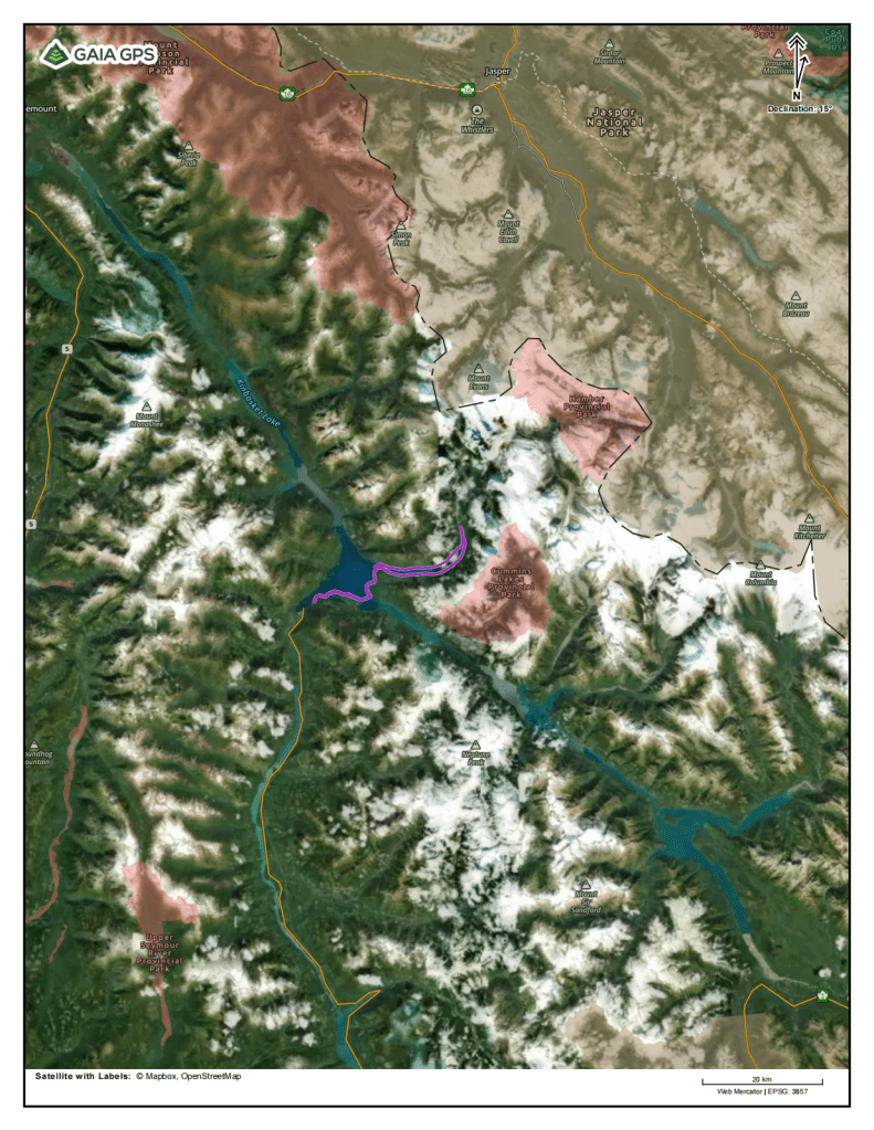
Kinbasket Lake. This trip’s route is outlined by the purple line.
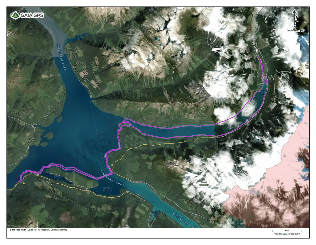
My 90km route to the Wood River and back again – Trip modified onsite.
Planning Considerations:
I’m still using a combination of Gaia and Google Earth online maps to figure out my route, route length, creek locations along the trip, where I could get fresh water to filter, as well as searching for large beaches and points that could make potential camping locations. I created waypoints for all of these important locations on my Gaia account online. The software then allows me to create a set of PDF maps on the Gaia website, that I can send to a local printing shop or print myself. The printed maps are usable as a navigation tool, in conjunction with a compass, as they have both a scale and the degree of declination between magnetic and true north. Along with the paper maps, I made sure to download the whole route onto my Gaia account on my phone, which then allows me to use my phone as a GPS device. I keep a waterproof case around my phone and it never leaves the inside pocket of my PFD, right beside my inReach Communication device, while on the water.
If you plan on tackling this route keep in mind that many days on the lake require a travel of long distances to find a campsite and sometimes it can be tough to even find a place to pull over for a break. Look for bays and coves to take breaks from the wind. If you are able, park your canoe or boat up against floating driftwood logs near the edge of the water to stay clear of the rugged and rocky shoreline. Keep an eye on the topographic lines on your maps to decide on which side of the lake to travel. There are not many camps located along steep shoreline sections of the lake. Often creek and river mouths offer camping options as well as large open beaches noted on satellite map imagery, but not always.
Getting To The Start:
The drive to Golden from Invermere is, in most years, a relatively quiet and relaxing drive and usually takes me less than 1.5 hours of driving, along highway 95. From there I drive north along Highway 1 towards Revelstoke, B.C.. From Invermere to Donald, I parallel the first 180km of my canoe route from last year and then the highway swings away from the lake, as it finds the easiest path through the remaining rocky mountains. The drive through Rogers Pass is quite amazing and I always find it difficult to keep attention on the road with majestic mountain views at every angle of view. I find it often takes me about 2.5 – 3 hours to drive to Revelstoke from Invermere, depending on how many stops I take. After A stop for fuel and a quick bite to eat and I’m back on the road again. This time I’m heading north along highway 23 out of Revelstoke, B.C, for a total of 150km, towards Mica Dam. The view along the Revelstoke reservoir keeps my mind busy. I imagine that I am canoeing along its shores and trying to find a campsite for the day, but can never seem to find the perfect one. After 4.5-5 hours, I make it to Mica Dam and then continue down the gravel road to find a place to park.
Day 1:
Potlatch Creek Recreation Site to “Bear Brook” Camp – 13 km
My first gaze at the lake, as spectacular as it is, shows me a sign that I will have to switch to “Plan B” for the first two days of my trip. I had taken too long to get my gear together yesterday, which didn’t allow me to get a jumpstart to my close to five hour drive this morning. After some previous experience on the large body of water, I am sure that I missed my usual calm morning opportunity to cross the larger bay created by Mica dam. Now nearing 12 o’clock in the afternoon, the winds were blowing hard enough to show constant white caps for more than half of the 1km paddle to the far shore. I decide I cannot cross and travel the large bay clockwise as planned, and I will take the reverse route of my last day on trip, the previous year and then travel counter clockwise instead. After finding a full campsite, common on the lake in the summer, a family allowed me to park near their R.V., which was a relief after a long drive. By 1 o’clock I was finally loaded up and ready to paddle off. Before I take off, often feeling rushed at the beginning of a trip, for the first time I take a moment to slow down, because that’s what this trip was supposed to be about. I take a few big deep breaths, I look around at everything I can see with intent, I listened as best I could to the sounds of the birds chirping and singing, the wind rustling the tall grass and reeds along the lake’s edge, the waves slowly lapping against the shore, I feel the cold water of the lake against the warm skin of my calf and finally I smell the fresh moist air coming off of the lake, mixed with the wild scents of the old growth forest to my rear – I am present.
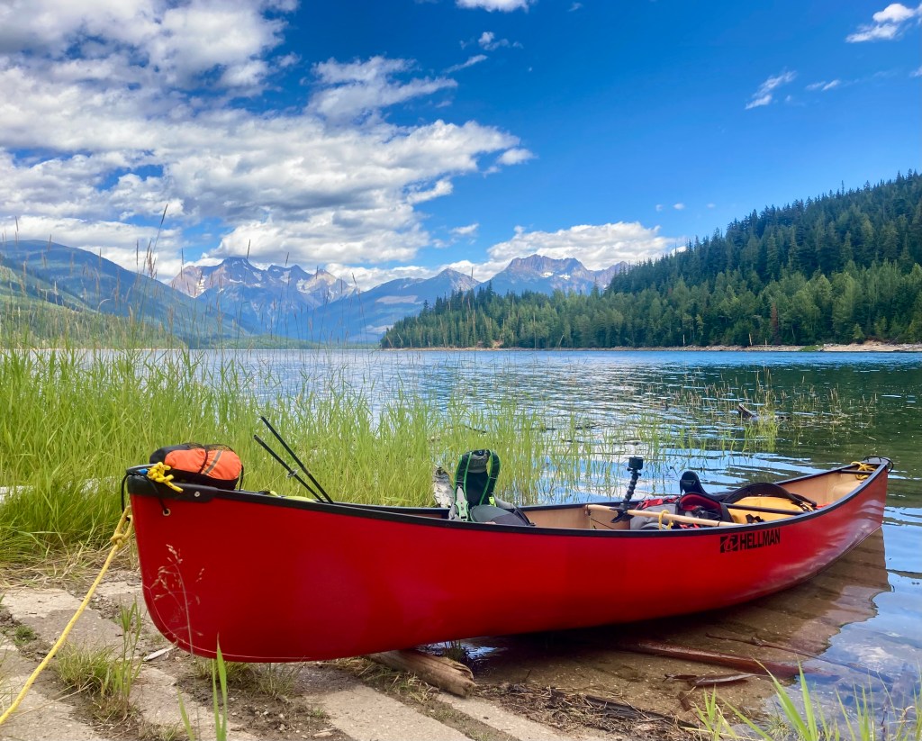
Loaded up for adventure.
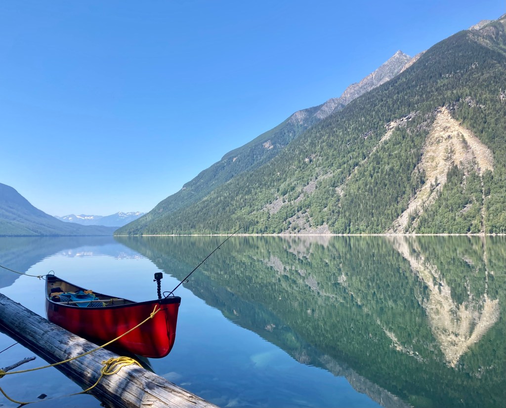
I keep near the southern shores of the lake and large peninsula travelling eastward, which allows me to skirt around the majority of the wind blowing in the wide open water and northern shore. After passing the last of the fishermen, often travelling not too far from the crowded camps, I finally felt the solitude I came for. Paddling along the eastern side of the large island like peninsula, I finally remember my own fishing rod sitting behind me and throw my line in to troll along, while I paddle the remaining few kilometres of sheltered water. Within the span of an hour I hook into two rainbow trout. The first takes me over 5 minutes of fighting to bring in, after multiple runs from the canoe. I release the deep and fat 23″-24″ trout, because it was far too much for me to eat in one meal and likely spoil in the heat. The second is a great keeper size for myself, however, at first glance near the canoe I see the trout has some sort of flesh wound on its back. I let off pressure on the line, which allows the barbless hook to slip out and the fish to swim off effortlessly. I don’t want to risk getting sick from a wounded fish and made a split decision to let it go. Now hungry for a fish dinner, I somehow manage to snap my line on a third fish about 15 minutes later and lost the only “lucky” lure in my small trip tackle box. I learn a few valuable lessons here, one of which is to re-tie your line after a couple long battles and bring more lures!
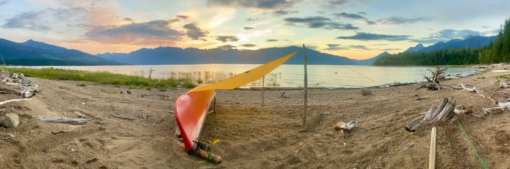
Now getting close to late afternoon, I made it to a point where the far shore was as near as it will get. I made up my mind that the water and wind were settled enough to make the 2.5km open water crossing. Even though this crossing went really smooth, it always amazes me how big and rolling the waves can get in the middle of some of the crossings, even when there is a calm over the lake. I make it to the far shore right where an old forest service road created an access down to the lake. It is nearing 4pm and after looking the area over, decide the old grown in road has enough room for a tent about mid way up, backed against the thick bush. The beach is long enough to spread out camp and although kind of tight, has about 16 feet of room before the open rocky floor turns into what appears to be an impenetrable wall of trees and bushes. Hidden in the thick bush, near the the road, is a very small creek (brook), which I could only barely hear and thought nothing else of it. This isn’t the best camp, but without knowing exactly what lies ahead, I don’t want to take a chance this late in the day and decide that 15km of paddling is enough. I’m supposed to be taking it easy anyway.
It is another bad forest fire season for western Canada and there are fire bans in place throughout all of British Columbia. The afternoon has been extremely hot like many others and feeling as alone as I am I strip down and jump into the shallow bay at my camp. The cold glacial fed water is ice cold even in this heat. I let the sun and breeze dry me off after the refreshing swim. The rest of the day I enjoy a great first meal of my own version of the “Pulled Pork Tacos” from last years canoe trip, minus the trout I let go, setup camp and relaxed on my foam mattress along the water’s edge taking in the scenery along with some reading, yoga and stretching. Normally I don’t stay up very late on trip as it is, but without a fire for light, I tend to chose the tent much earlier and retire just after 9pm.
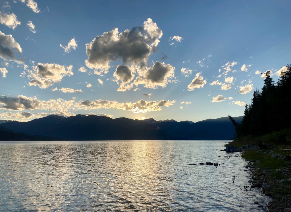
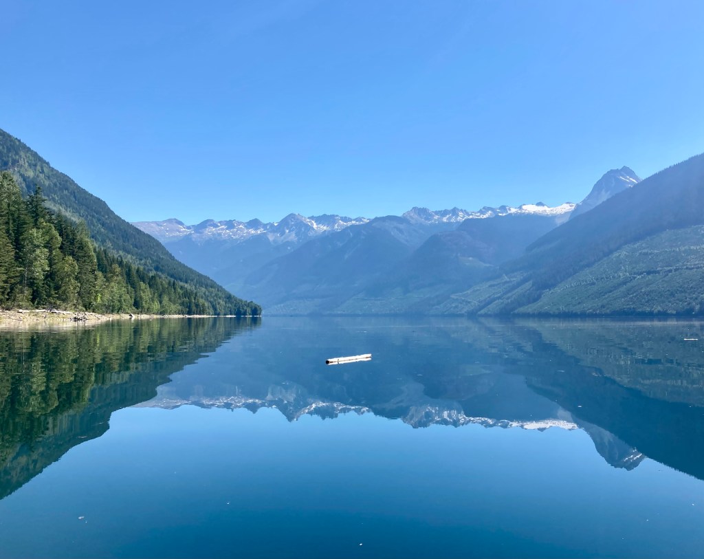
Looking southwest from camp – David Thompson’s “Boat Encampment” at the confluence of the Canoe River and Wood River, near the Columbia River confluence, now sits underwater.
Day 2:
Bear Brook Camp to Moose Island Camp – 14km
When I first awoke the sun was already shining and warm. My black toque is pulled over my eyes to keep out the light and allows me to sleep in until almost 7:30am. Not long after rubbing the sleep out of my eyes I heard a squirrel chirping not too far in the distance behind me. Growing up hunting as a teen and young man I learned that squirrels often gave away my position as well as sometimes my prey… and other predators. In that drowsy moment though, I didn’t think anything of it. I opened the door on the tent so I could get a view of the lake, while I lay in my sleeping bag and enjoy the morning for a while. I notice a lone raven fly and land on my canoe after circling around and begin to make a racket. Not long after I began to hear a crashing in the woods behind me and movement in my direction. At first I assumed a moose, due to the lack of trying to be sneaky, but before I knew it, the animal was getting really close. I picked up my small air horn from the tent pocket and gave it a blast. The animal gave out a large grunt and I knew right away it was a bear and not a moose. I heard it moving quickly toward me through the trees. I fumbled briefly with my bear banger launcher pen and finally shot an explosive projectile out over the lake, as I got out of my tent in the same motion. After the loud boom, the bear ran in the direction it had come and I move to a stump on the beach to get a better sightline and defensive position. Looking around, I can’t see anything outside of my little clearing along the lake, except for a tiny silhouette of a black bear cub at the top of a pine tree some 15 meters up, the base of which was just a few feet away of my tent. I take a few minutes to decide what to do. I felt bad about scaring the small bear and it was quite obvious the mother bear didn’t originally know I was there in my tent. I assume she was bringing her cub to get water from the hidden stream near my tent, like she probably does most days that time of year, but this time I was there unknowingly waiting. My only real option is to take a long walk down the beach, go off into the forest in take care of my morning business. I fill back in my cat hole, sanitize my hands and walk back out to the beach. As I approach my camp I don’t see the young bear at the top of the tree anymore. I carefully move toward my tent and find the area abandoned. “Phew”, I said, “That was a close one!”. I packed up camp, made my usual breakfast of oats, berries and protein powder. Today is an exciting day, because I get to explore a new area of this giant lake and I couldn’t wait to get going.
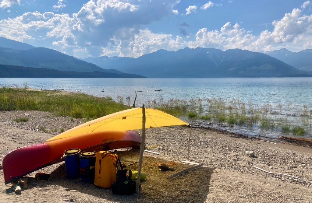
I paddled past a few better campsites, than the newly named Bear Brook campsite, from my encounter this morning. There is also a lot more rocky, wood choked and rugged shoreline, which allowed no landings. The morning was mostly calm as I moved north toward the mouth of the Wood Arm and a small archipelago of islands, where I hoped I could camp for the night. After a few hours on the water I came across a long gravel beach, which was mostly in the high noon sun and pull in for lunch. It is already blazing hot out, so I decide to take a swim before lunch and relax on the shore, while my ramen noodles rehydrate in the pot of boiled water and I chew on a piece of beef jerky.
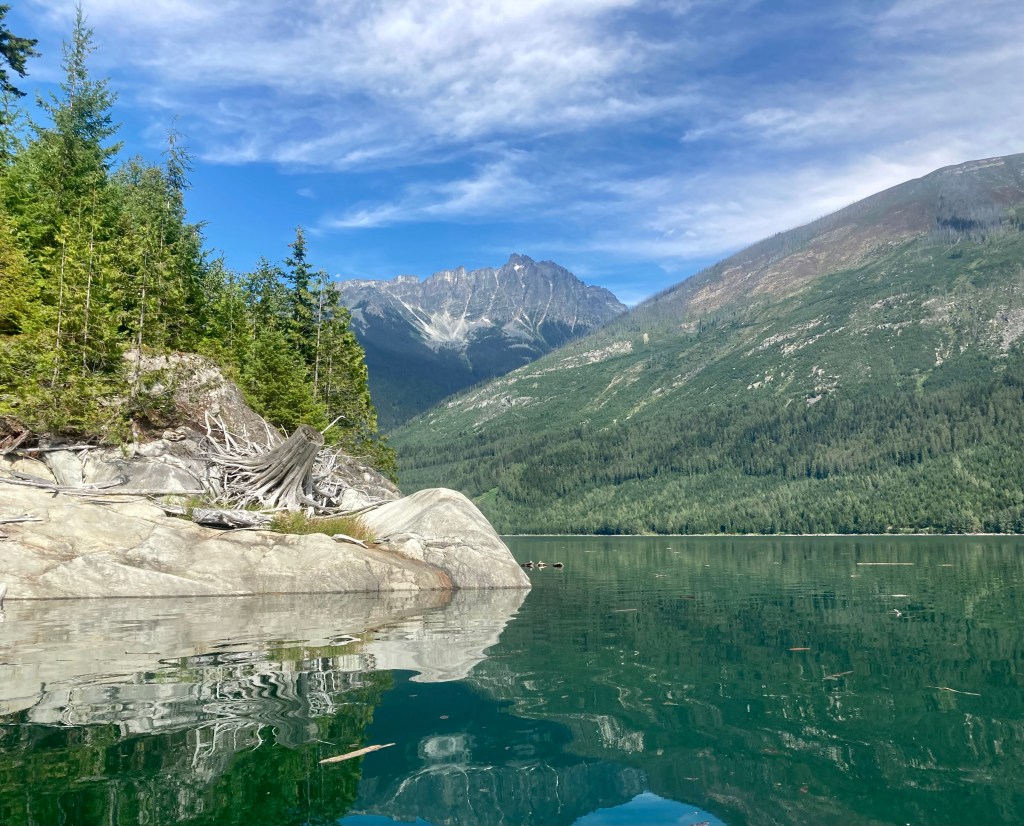
Lunch and a swim. Looking West toward Canoe Arm.
Between Bear Brook camp and the islands I find a few creeks entering the lake, which gave me an opportunity to fill up my 6L water bladder. Moving along this stretch of the lake was a real treat. There are large shelves and ramps of limestone and sandstone all along the shoreline, creating many places to jump in for a swim and relax to dry off. It reminded me of a sea coastline or maybe what I imagine the Canadian Shield to look like, except it would be made out of granite, quartz and other harder types of rock.
By the time I reached the islands, I had spent much of the day slowly paddling the shoreline and taking in the views all around. After landing on the first and largest of the 5 islands I wandered around it to find no suitable camps. It was still early enough for some more exploration, so I decide to paddle around all of the islands to look for the best campsite, if any can be found. The area between the islands and the south shore offered some protection for the weather and I found lots of waterfowl in the area, along with 4 blue herons, the islands main inhabitants.
Taken from big island, looking east toward Wood Arm.
I paddle around every island in full and finally find a suitable campsite on the last and smallest of them. It is an island, but at one point it was a hill top and is made almost entirely out of rocks ranging anywhere from the size of a pebble all the way to large boulders, yet little to no soil. There was a large amount of moose droppings in a few places on the island and I expect they use this island’s trees and low points as winter shelter. I setup my tent on one of two high points, the other I reserved for my cooking area. I spend much of my free time this evening looking back over the large open expanse of water that I have travelled and thinking about the wild lands I will encounter up the wood arm tomorrow. In my tent I listen to the sounds of loons and geese, as well as calm waves licking the shore and I slowly fall to sleep.
Sunset from the small island camp.
Day 3:
Moose Island Camp to Wood River Mouth Camp – 22km
The morning is clear and only cool, not cold. By the time I am packed up and ready to get on the water, the waves have picked up slightly. My plan for the day is to travel the north shore of the Wood Arm all the way to the end. Having previously looked at satellite imagery and topographic maps, it appears like the only possible camp locations can be found near the mouth of the Wood River itself, on a broad flat-ish looking area. The 700m crossing from the small island camp to the northern shore is made easy with a slight tail wind. I came across a creek flowing down from the mountain not far from my crossing and I stopped in to fill up my water bladder, once again. I could hear this creek through the night when the breeze was at its slightest. The drainage was mostly shaded and felt damp and cool, like a miniature rainforest. I looked up to find an old trappers box up in a tree. It is made of plywood, so I presume not more than 50 years old – still interesting to see winter use in such remote and historical area. I slowly explore most of the entire north shore of the lake, as it jutted in and out. It made for a much longer and drawn out day than necessary, but I enjoyed taking my time and seeing as much as I could. The hard part of travelling east along this side of the arm was the lack of shade from the sun and I thought this may be an issue today.
Part way down Wood Arm. Perfect paddling conditions.
It is high noon and I am starting to overheat. After finding some shade in a small bay facing away from the sun I pull my canoe up to a car size flat rock along the waters edge. It is perfect! I call out “Heyooo”, as I always do, to see if I can entice a hidden animal to move or maybe scare it off. I don’t hear anything in the thick forest and the only place to land that wasn’t bush was the flat rock. I step onto the rock and begin to tie up my canoe, when I hear a sound that I am becoming far too accustomed too – the warning grunt of a bear. Quickly, I untie the canoe, hop back in and push off into deep water. I hear the bear slowly move away from the shoreline, where the shade and water create a cooling affect for the first few feet near the waters edge. Move on down the lake looking for another lunch spot. After exploring for the whole day, it’s nearing 4pm and I am getting close to the end of the Wood Arm and have not seen one campsite in over 18km, which can be common on tis lake. Finally not far from the mouth of the Wood River, I come across one of a few campsites in the whole arm and pull in to check it out.
Rounding another point, near the end of Wood Arm.
One of my reasons for wanting to come up the Wood Arm is to explore a small part of a historic fur trade route, even though much of it is under water at present day and to scout for a future, much larger trip up and over Athabasca Pass, where David Thompson crossed the Rocky Mountains on his second route over. I push on past my possible campsite at the end of the arm and paddle up the slow current at the mouth of the Wood River to see how far up I can make it. Eventually the river narrows and the current is too fast for myself to paddle against – 4km up from the current lake edge. Most of the area of the lower river, near the lake is marshy and soft local glacial till, which I have been told can act like quicksand. It’s best to stay away from this area by foot or use animal paths until solid footing is found away from the flood plain.
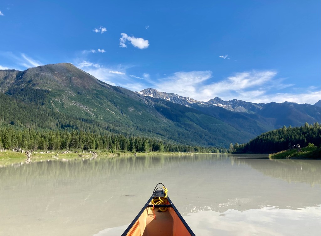
Paddling up the very silty Wood River.
It felt nice to casually float back down to my known campsite at the ned of the arm and by 6pm I had landed on shore. The old bulldozed landing had been made some 30 years prior during logging of this remote area by barges and ferries for transportation. The area now almost completely regrown, had looked like nothing had happened, except for the large crushed rock landing I stood on. Down near the waters edge and closer to the forest nature was taking the landing back slowly. Not far away there was a large creek gushing water into the lake, which I know will create a slightly cooler and damp campsite come morning, but is great for filling up the water bladder and cleaning up. Just like on the island camp, before dark, I once again see 4 more blue herons flying overhead, playing with each other, before landing on a marshy island just off shore for the night. After dinner, I take in the views, now at my trips planned destination. I am truly amazed at the beauty this lake holds, in each of its many corners. As I drift off to sleep, I imagine what it would have looked like 200 years ago, when David Thompson came down the Wood River after that cold January crossing of the Athabasca pass?
Day 4:
Wood River Mouth Camp to Moose Island Camp – 18km
The morning is clear, cold and damp, being that I am camped between the mouth of the Wood River and a heavy flowing creek entering Kinbasket Lake. With little choice of campsites along this arm, which reminds me of pictures I have seen of the giant fiords of Norway, I had little choice, but to camp here last night. Sure I would have preferred a drier campsite, but this site allowed fresh water near by, a large, rather flat opening and grand views of the mountains all around.
Late morning view from Wood River Mouth Camp.
The sun is hidden from me until just after 10 am, now paddling along the much more shaded southern shore of the arm. The first two – thirds of the day allows for calm paddling and I choose to do more large bay crossings to speed up my progress, rather than explore every inch of the coastline, like I did the day previous. There are more places to stop along this side of the arm, get some shade and stretch the legs, but the only good campsite areas I could find were at the very end, near the mouth of the river.
A shaded point used as a picturesque lunch location.
This arm holds a few hidden gems, which are often heard from hundreds of kilometres away, before ever getting a slice of a glimpse. I came across 3 magnificent waterfalls today and 1 giant yesterday. These damp, log choked, canyon like inlets of the lake offer me a cool mist and shade after travelling during the heat of the day. I enjoyed the varied experience of feeling like I was in a different world, if only for a few moments, each time I paddled into these magical retreats along the steep shoreline.
Somewhere near 3pm some forecasted winds begin to pickup, and my leisurely paddle day slowly turns into some minor ocean like conditions. I have experienced some big waves on this lake, and stayed off it during much larger ones, but these ones landed somewhere just above my comfort zone. I knew if I stuck to a plan and stayed relatively close to shore and kept the bow of my canoe quartering the waves, everything would be fine. The wind is not blowing strong enough to prevent paddling, but with such a deep body of water and long fetches for wind to travel, large rolling waves are bound to happen, even with little air movement. Without many options to land and knowing the lack of campsites along this arm, I choose to keep going. I stick to a plan and paddle non-stop for almost 3 hours. Every 100m or so, I would point the bow of my canoe out into the open water of the lake, so I can paddle west, while still maintaining a quartering affect on the waves, with my canoe. Once I feel I am getting too far out into the open lake, I time a turn between waves, swing my bow back towards the rocky, steep or often log choked lake edge and continue diagonally “zig-zagging” along the shoreline towards the only safe campsites I know in the area – the archipelago at the mouth of the Wood Arm.
Back near the islands the waves and wind have calmed down, so I take the more direct, outside channel around the islands and land back on the rocky and small, “Moose Island” once again. I setup camp in the same location as a few days ago, knowing exactly where to find a flat and dry spot for my tent once again. With the calming of the weather a warm front quickly moves in while I eat a late dinner and take in the views, which brings back the intense heat that existed the last few days. Without knowing it I went to bed thinking the forecasted storm was over, but little did I know, that intense warm front meant something else….
Day 5:
Moose Island Camp to Paradise Beach – 7 km
I quickly snap awake at 1am to the most terrifying storm I have encountered in my entire life. Over the course of 4 hours I see dozens of lightning flashes through the walls of my tent, so bright that I had to shield my eyes. Counting only seconds between the blinding flashes lighting up my entire tent and the thunderous booms that closely followed, I knew the storm was right on top of me. The thunder echos through each of the four giant arms of the lake in my vicinity and the sound of bombs carry on for upwards of a minute at a time. I knew the trees around my tent were strong enough to battle a wind storm, but now I was terrified of being struck by lightening. I had thoughts of trying to find a lower location than the rise I was on, but then I would have to leave the dryness of my tent. I decide to stay and literally put my sleeping bag over my head. Eventually I fall asleep and wake to a faint light coming through the tent and birds chirping nearby – I now know I didn’t die and was relieved to smell the fresh and moist air. Before leaving camp that morning, one more short rain shower fell on me, materializing from somewhere up the Wood Arm.
Staring at the one last island I had yet to put my feet on, I paddled the short distance to the most westerly and smallest of the islands, sized about 30 feet across and bare except for some low foliage, bushes and shrubs. Now feeling like I have properly explored this area of the lake, I get back in my canoe and slowly make my way home. Winding my way back along the shore towards my first nights camp, now rotating clockwise, the wind again begins to pick up. After leaving camp late, I am caught up in a common high noon wind, which can last a few hours or more. I pull in for lunch and to refill my water bladder at a clean flowing creek some 4 km from my last camp. I hoped a short break would allow the wind enough time to slack, but with no end in sight for a few hours I am back standing in the swell pushing my boat far enough from shore to jump back in. Once again, using the same “zig-zagging” method as yesterday, I paddle around 2km switching back and forth, until I made it around a large point and behind cover for the time being.
I know I don’t want to camp back at my first nights “Bear Brook Camp”, and I remember passing a few gorgeous looking locations on the morning of day two, paddling towards the mouth of the Wood Arm. I check my GPS for the waypoints I installed a few days prior and notice one is coming up in less than a kilometre. I round a point to see a long 1km beach, with lots of room between the water and shore, ample dry wood and flats spots for tents. I push on to the far end, and decide on a location where the beach narrows a bit and there is a mound of earth sheltering the area along its flank.
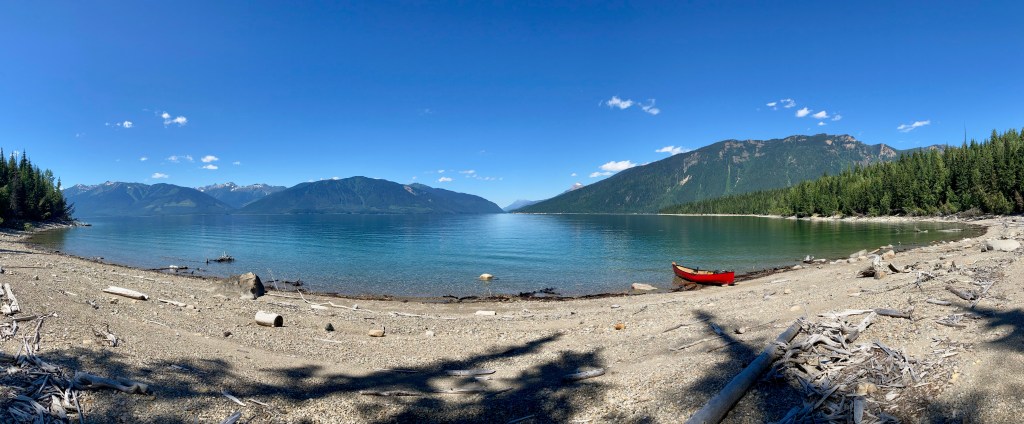
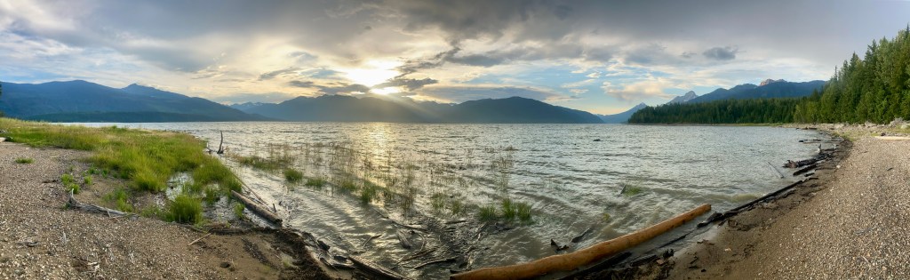
Paradise Beach Camp. Slowing things down.
Not long after setting up camp, the wind died down, the sun came back out and I realized how lucky I am to have found this location – I am in heaven. After travelling a little more than 7km for the day, I am all setup and it is only 3pm. I decide to finally slow down and take a few hours to read, snack and journal under my tarp stretched out on the gravel beach for shade and next to my canoe for a wind block. The afternoon is warm with a slight breeze. Later on, as the light starts to dim I head down the beach away from camp to make dinner.
End of day 5. Watching the sun go down.
After my last dinner on trip I take to my tent early, tired from the sleepless experience the night before. I end my night relaxing with the fly doors open, so I can see the magical 180 degree lake and mountain views. The sun now behind the mountains to the west, I drift off to sleep under a peach coloured ski, with the sound of waves crashing on the beach.
Day 6:
Paradise Beach to Potlatch Creek Recreation Site – 15 km
The morning was calm as I packed up. There was a short 2km paddle before the open water crossing, back to the peninsula and the south shore of this large portion of the lake. The morning is often one of the best times to make crossings, with the wind usually still rather tame and the lake calm.
The view from camp on the last morning.
I stop in the middle of the open water crossing to look east, back the way I had travelled from the year previous and for a moment reminisced on the enjoyment I got from that trip. After once again making the long 2.5 km open water crossing without incident, I’m back paddling along the familiar shores of the peninsula and winding in and out of its many bays on my way back to my pickup. Nearing the end of the giant island like mass, I see a man on shore for a split second and then he disappears. In just a few moments I notice him paddling a wooden kayak directly at me and after not seeing anyone for the last 6 days, wondered what he might want. “Hi!”, he exclaims, “My name is George”. He saw my canoe full of gear and being a fellow adventure paddler himself, thought he had to come and speak with me. He is interested in exploring the lake further on a future trip and is hoping to get some camping information from me. We exchange contacts after a lengthy chat and then he is on his way as fast as he came, paddling his homemade, wooden kayak – being a journeyman carpenter, I was quite impressed with his vessel.
I am not in a rush and take my time on the last 4km, dipping in and out of the many nooks and crannies found along the water’s edge. After paddling into the small bay, where the boat launch is located for the small recreation camping site, I pull my boat up on shore, and was greeted by an older couple who was camped nearby. They said “Oh, you made it back”. After a brief chat they told me that the people in the campsite knew about my little adventure and they were all wondering when I was to return. They invited me to their R.V. for some lunch. After speaking with the people who looked after my truck for the six days I was gone, I took up the couple on their offer. They had stories about that end of the lake that dated back as far as 38 years. They had been out to the lake every summer since and spent at least 2 weeks, but often more one site. The stories and history of the lake was very interesting to hear. Now nearing 70 years of age, this couple had some advice for me about many of their friends and life. Having waited and saved most of their adult lives to actually live and do the things they wanted during retirement, it was sad to hear many of their friends had passed not long after receiving their last paycheque, often due to unforeseen health problems. It was always their idea to live each day to the fullest and were happy to see me out tackling wilderness adventures and trying to get the most out of life. Its a great reminder for me, that I am on the right path in life.
Getting Home:
Again, another simple trip return after this trip. With my vehicle sitting idle and waiting, all I had to do was load up and drive home. I stopped in Revelstoke, B.C. again, this time for a more formal sit down lunch. I had a great Burger and Fries Nomads Grill, before hitting the road towards home. After getting fuel in Golden, B.C. I pushed on for the last stretch to home and made it back to Invermere at 7pm after 5 hours on the road.
Conclusion:
This whole trip was about slowing down after a busy few years at work and moving to the beat of my own drum, but that’s actually a privileged way to look at it. When we are out on a wilderness adventure, it’s often the weather that is most in control of how and when we travel – Mother Nature. I was reminiscing about the whole trip on the last morning, while packing up. I wrote most of this next passage that morning and the rest on a portion of the drive home. I think it’s a great conclusion to the experiences I had on this trip – enjoy.
“A lone loon calls out as I turn on the gas and spark up my camp stove for one last breakfast of oatmeal, tea and dried berries. There is a sense of urgency on my mind to make an open water crossing, before heavy winds arrive and yet I don’t feel rushed. The waves slamming along the rocky shores and swirling winds from the previous night had subsided. Pastel blue skies mixed with a firework-like explosion of small, white and grey cumulous clouds created a calm vibe in camp. My canister stove, now sitting idle after boiling the pot of water, allowed the loon to once again be the dominating sound in the bay. Once I finished eating the hearty meal, I kneel down on the damp sand and gravel beach beside my tent, which was placed midway between the water of the lake and the thick, dark forest above. I meditatively begin to pack up my gear, my mind wanders and I start to reminisce about the previous five days. I think to myself, “What does adventure mean to me and did I find it on this trip?”.
Adventure to me is about the excitement of rounding a new point and seeing the hidden gems that lay beyond. It’s about putting my foot on every island I see to feel the ground under my feet. It’s about the cool breeze and spray on my face, when I’m looking up at a waterfall from a log choked, gorge-like inlet of the lake. It’s paddling non-stop for hours through ocean-like conditions, so tomorrow I can say, “That wasn’t that bad.”. It’s being in my tent during the most violent thunderstorm of my life and wondering, “Is this it for me?”. It’s about seeing the most amazing mountain, beach and lake views, that I cant imagine could be topped and then seeing 20 more that same day. It’s wondering whether that’s a moose or a bear in the bushes, just feet from my tent.
Adventure to me is about the sweat, the sore muscles, the tears, the laughs and the smiles. It’s freedom to roam, pushing just beyond my comfort zone, staying curious, learning, growing, moving to the beat of mother natures drum and getting up to do it all again tomorrow.
Did I find adventure on this trip? More than I could have asked for.” – Tyerel Raven
What does adventure mean to you? Let me know in the comments.
Keep following along for more human powered adventures, blog and tips. Make sure to get out of your comfort zone.
Happy adventuring!
Tyerel Raven

Leave a reply to TBE Cancel reply