"Hey... Bear!", this time I yelled out, trying make myself heard above the sound of the braided water courses and slight breeze in the tight valley. The silver haired bruin finally heard me and with a quick glance of its piercing black eyes, I was surprised to see it charging directly at me...
Route: Great Divide Trail, Section C – Upper Kananaskis Lake to Sunshine Ski Resort (Modified Trip, due to forest fire closer).
Trip Length: 110km – Hiking.
Trip Dates: August 11, 2018 to August 17, 2018 – 7 days on trail.
Special Notes: Busy National and Provincial Parks in this section make it very difficult to obtain the necessary camping permits to tackle this and a few other sections of the Great Divide Trail. You may need to shorten or lengthen your itinerary to make a trip doable.
The Trail:
The Great Divide Trail is a long distance hiking trail, which stretches over 1100km long and is located in western Canada’s Rocky Mountains, also know as the Continental Divide. This special geological formation is the headwaters of many tributaries and rivers, whose life bringing waters eventually travel all the way to the Pacific, Atlantic or Arctic Oceans. The Canadian Rocky Mountains kept the fur traders of the late 1700’s from reaching the Pacific Ocean until names such as Alexander Mackenzie, Simon Fraser and David Thompson managed to find the difficult passes through, with the help of their First Nation and Inuit guides. This top tier hiking trail is quickly becoming well known as one of the toughest and most scenic long distance hiking trails on the planet. This is also one of the few places left you can still find glaciers, turquoise alpine lakes, never ending forests and some of the largest predators and ungulates on the planet, along with many different birds, mammals, rodents and fish species.
Section C is well known for its scenic views and for the most part, its well maintained trails and camping facilities, being that it crosses through Peter Lougheed Provincial Park (AB.), Banff National Park (AB.), Assinaboine Provincial Park (B.C.), Kootenay National Park (B.C.), and Finally ending in Yoho National Park (B.C.). This 200km portion of the trail starts at Upper Kananaskis Lake, in Alberta and winds its way northward through the wilderness of the Rocky Mountains ending near Field, British Columbia.
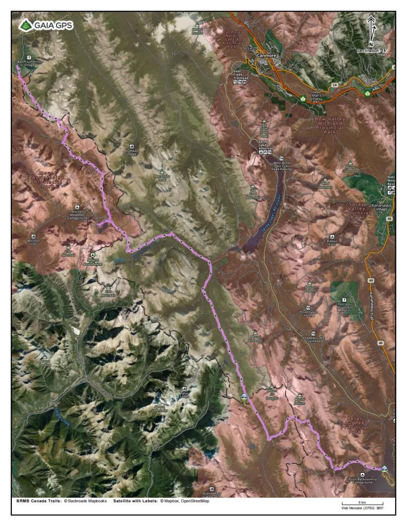
Satellite Image Map of Section C Route – Source: Gaia GPS App.
My Adventure:
Its nearing the end of August 2018 and after a few summers of pushing myself out of my comfort zone and tackling some multi-day hiking trips, I am itching to test out my skills and knowledge on something bigger. I had my eye on Section C, of the Great Divide trail in Canada. At the time it was hard for me to find any friends who were interested in going beyond about 5 days or 100km on a hiking trip. I had already made a deal with myself after my back injury a few years prior. I wasn’t going to let the absence of other people hold me back from getting out on the trips I was interested in pursuing and if I couldn’t find someone to go along with me, I would find a way to go alone. The feeling of solitude in the wilderness, getting dirty, living the “man against wild” lifestyle, you so often hear described in movies, books and on social media, and to challenge myself mentally and physically are some, but not all of the drivers behind this first “big” trip. There is also a need to get away from the distractions of a busy world as well as test how my body would fair after my back injury, with a heavier load, a longer distance and more time away from my comfort zone, than I have ever experienced.
This summer has seen its fair share of wildfire smoke, due to tinder dry conditions in the forests of the Canadian Rockies along the Continental Divide and the interior of British Columbia as well. A few days before my trip a large 80km portion of Section C, of the Great Divide Trail was closed, due to multiple forest fires encroaching on areas of the trail. This was a stretch from Sunshine Ski Resort in Banff National Park, to the end of the “Rock Wall” section of trail in Kootenay National Park, which basically cut my trip in half! I was feeling a bit low in having to change my plans and shorten the length of my hike. At the time I didn’t see it, but I was being taught a valuable lesson about trip planning, spending time in the wilderness and in life for that matter – learning to manage my expectations, go with the flow and adapt to the ever-changing world around me. Realize that I can plan an outline of an entire adventure or a day trip, but once I set foot out that door, the day and the adventure take on a life of their own.
Planning Considerations:
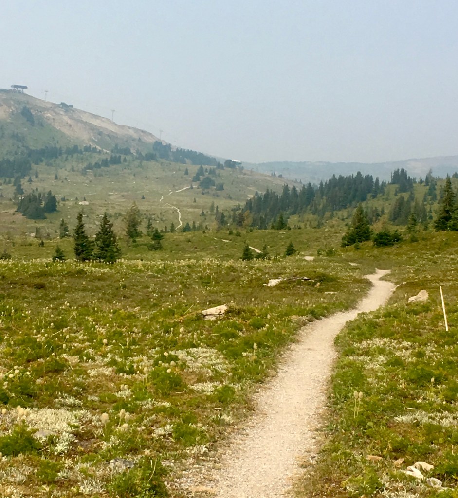
One of the best resources for this hike is the Great Divide Trail Website – greatdividetrail.com. There are quite a few helpful resources located here. A document with a list of every formal campsite along the whole trail, including national parks, provincial parks, recreation sites and some random camping is available for download. Some the benefits of this document is information on how to get specific permits, the types of amenities at the camps and their distance from both ends of the trail. There is another downloadable document that has a printable, basic map that can be used with map and compass for navigation, if you so please and a backup navigation method is always recommended. A map on one of the website’s pages overviews the entire trail, and shows important points, such as the beginning and ending of each of the 7 sections of the Trail – A through to G. With even more useful information found there, the Great Divide trail Website is definitely a source you want to check out.
I normally prefer to use Gaia GPS App (Premium), a Garmin Product (GPS Device), and/or a map and compass for all of my adventures. I alway have a paper map(s) on a larger trip, along with at least one device, such as a smart phone in a waterproof/shockproof case or a stand alone GPS Device. For shorter trips, such as a day trip, sometime even a mental map and phone GPS will be sufficient. For the sections of the Great Divide Trail that I have hiked, I preferred to use the Far Out Guides App – formerly known as Guthooks App and a paper map set. This app has purchasable map packs for many of the long trails around the world. The app is simple, it runs fast when off grid in the backcountry, and has all of the important information you need for the trail and nothing else – a great elevation profile of the trail, a simple map, with a line for the main trail, different coloured lines for exit/resupply/emergency routes and another one for alternate trails. The map also shows campsites, water sources, mountain passes and points of interest, all of which have a message board, where hikers can leave notes for other hikers to see trail information that may have changed for that changes seasonally.
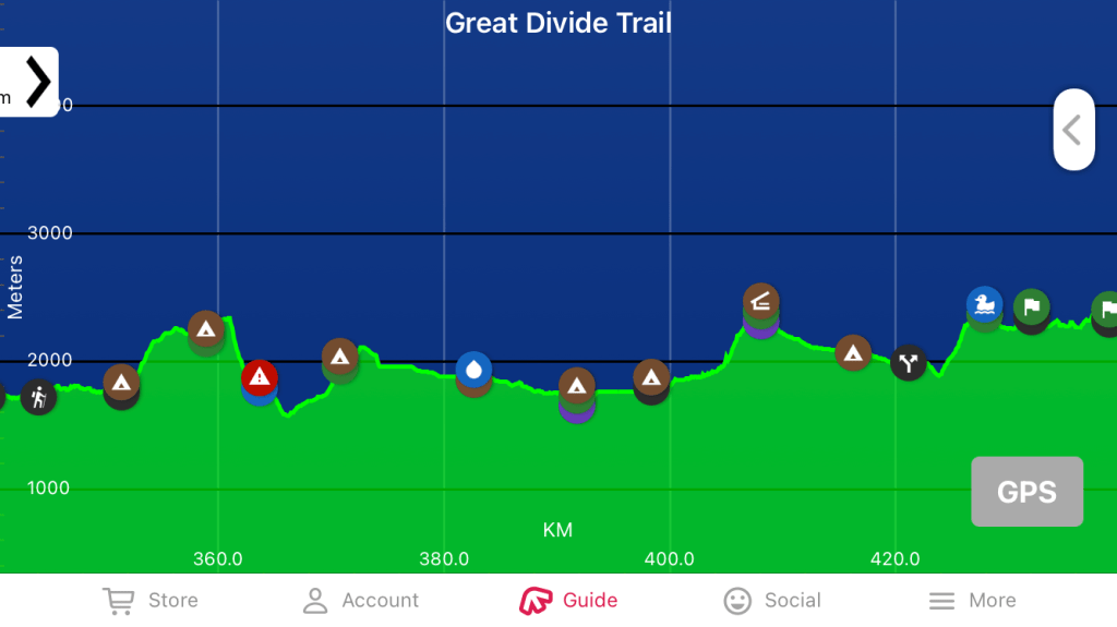
Elevation Profile for Section C – Source: Far Out Guides App.
There are also a few Facebook Groups that you can join to get plenty of additional information as well, just make sure to keep an open mind on these types of groups and realize that not everyone has the same goals or same hike in mind – “Hike your own hike”.
This being my first solo trip, I thought I should make the smart move and invest some money in a personal satellite locator beacon/messaging device. After looking at a lot of options and finding out that the local Search and Rescue group uses this brand, I decide to get a Delorme Inreach (Former name), now owned by Garmin – Garmin InReach. My device has been great over the years and is something I don’t go into the backcountry without. I can message family or friends back home, to let them know I made it to camp for the day, to write that I am still onetime or that I am going to need to be pickup a day early, etc… It also has the function of an SOS button, which can be tripped if I’m ever in an emergency and within reach of emergency/rescue technicians. Fingers crossed I never need to use this.
Getting To The Start:
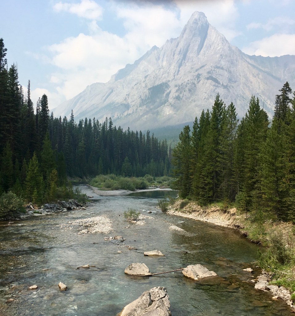
My parents helped me with this vehicle shuttle, which you will see in future trips is a reoccurring theme and has been extremely helpful. I am really grateful for their help to pursue my dreams. The drive from Invermere, British Columbia to Upper Kananaskis Lake, Alberta took us around 4 hours. While driving through both Kootenay and Banff National parks along Highway 93, I was able to take in the usual views of rugged peaks, mostly untouched wilderness, save for some old wildfires, and if you are lucky, the odd wild animal. Once over the mountain pass and into Alberta, Im on Canada’s famous Highway 1 at Castle Junction, and get a brief view of an iconic Peak and old landmark – Castle Mountain. After dropping my pick-up truck at Sunshine Ski Resort, for access at the end of the trip, we made a quick food stop in Canmore. Turning south off of Highway 1, I took in the views of the slightly lower, but more jagged and maybe even more intimidating looking peaks along the eastern slopes of the rockies, down highway 40. Finally we found the parking lot at the east end of Upper Kananaskis Lake, near the end of Highway 40, in Peter Lougheed Provincial Park. My Legs were restless and it was almost time to get going.
Day 1:
Upper Kananaskis Lake to Turbine Canyon Camp - 15km, 550m Gain.
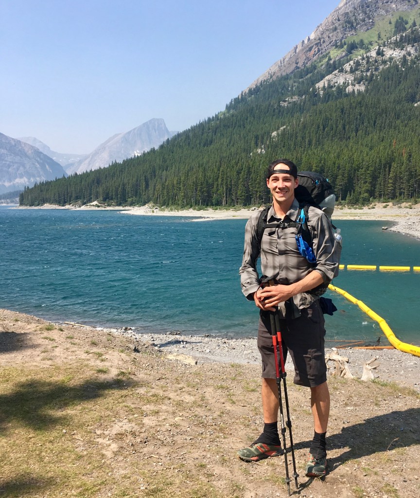
Ready to hit the trail!
East end of Upper Kananaskis Lake, Alberta.
A few hugs, some good byes and I hastily take off over the earthen dam at the head of the lake. I slip out of sight of the parking lot into the woods and begin following the shoreline heading west along the trail. It’s 1pm and I need to travel 15km to get to my first permitted camp, which lies near the continental divide and the border of Alberta and BC. For the first 7.5km I was cruising along on a wide, hard packed earthen or sometimes gravel trail. The trial did roll slightly up and down as it snaked along the lake, but for the most part it was relatively flat. I pass numerous child haulers being pushed back to the cars, by overtired parents who have taken their children on what appeared to be their first wild camping trips. A few easy to access campgrounds, only a few kilometres from the parking lots, allow the next generation a glimpse into the good life of camping in a tent near a mountain lake. A few others out for an easy day hike with those famous Rocky Mountain views in the background.
Eyes peeled.
Once past the lake the people lessened, the wide trail slimmed into a single track and the real hiking begins. The trail climbs up through a thickly grown in old avalanche path with mountain views all around, now above the thick valley forest below. Once gaining all of the days 500m of elevation gain, I take note of a large amount of grizzly bear tracks at a small tarn near my path. This was a gorgeous grassy spot, in a slight depression, where I take a needed break, now only a few kilometres away from camp.
More bear sign, but still no bears.
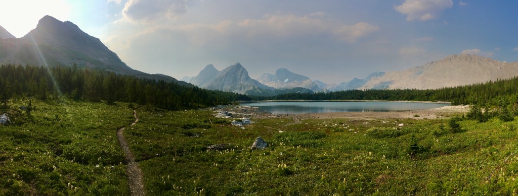
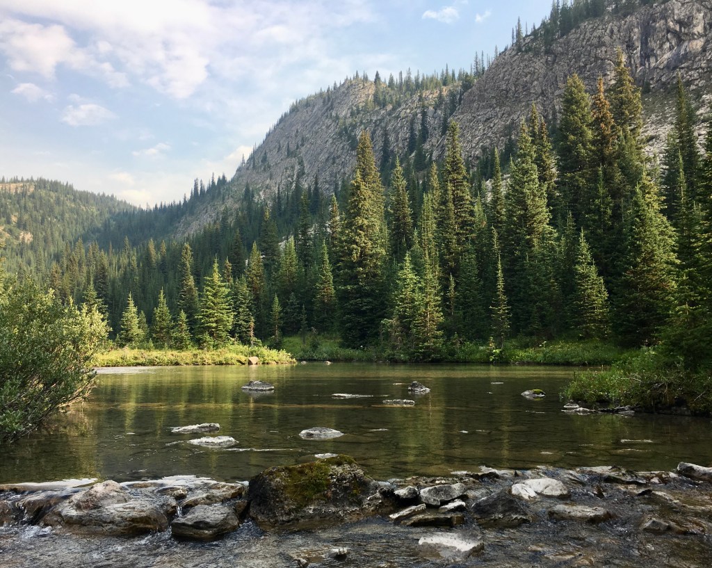
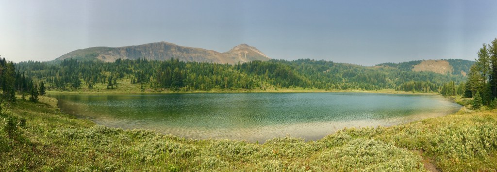
Not far down the trail I stop again, to take in the moment at a gorgeous tree-line meadow, complete with a bright blue lake and a smokey backdrop of jagged peaks. With the days hike now behind me, I cross over a park bridge and tiredly stroll into camp around 6pm. The turbulent water flowing under the bridge from the pass, where I am headed tomorrow, has worn through the rock and created the deep and menacing looking Turbine Canyon over the centuries. This water on the east side of the great divide, will flow into the Bow river of Alberta and eventually to the Atlantic Ocean. I pass through the small camp cook area and walk by some over night hikers. They are storing their food bags in the typical metal food lockers you often see in provincial and national parks in Canada and I follow suit. After finding the most remote of the ten or so tent pads, nestled near the forest’s edge, I unpack my bag and commence my normal backcountry routine of setting up my tent, then blowing up my sleeping pad, followed fluffing up my down quilt and finally my foam pillow as well. I move back to the cooking area and prepare one of my favourite camp meals -dehydrated spaghetti and bolognaise sauce. As I wait for the mail to rehydrate, I chat with a few of the hikers sitting near me and find that I am the only one from the camp heading over the pass tomorrow. This creates excitement in me knowing I am finally moving away from the crowds to more remote country, where I can find some real adventure – or at least that’s what I think I am looking for. Back in my tent, the fresh cool air let me drift quickly off to sleep, with thoughts of the wonders I might come cross on trail tomorrow.
Day 2:
Turbine Canyon Camp to Palliser Pass Camp - 12km, 600m Gain, 750m Loss.
My eyes had just opened as the sun started to peak over the mountains, from the direction I had started the day before. I was eager to hit the high point of this part of the trip – North Kananaskis Pass, on the continental divide – and drop back down into my home province of British Columbia. I am curious to see the upper reaches and head waters of the Palliser River, one that I grew up hunting along its lower reaches with my father a young man. I leave the camp behind, before many have left the warmth of their sleeping bags. The climb to the pass is short and sweet. Just enough to get my heart pumping with the 2kms and the 100m of gain. After a a short break to take in the pastel morning skies, the pristine alpine lake and the fireweed growing along its shores, I pass the height of land marker and look over the edge. The grade was incredibly steep, the drainage below narrow, deep and wound between high mountains on all sides, except one – heading west. There was a thin strip of vegetation starting near the base of the decent, which grew into a thick forest along the banks of the small water course. This is the Leroy Creek drainage, which I would follow for the morning until I reach the Palliser River confluence and then turn north. I took one look back at the sun rising above the peaks behind me and step down over the edge. I didn’t know it yet, but I wouldn’t see anyone for the next two and a half days.
Maude Lake
North Kananaskis Pass, Alberta.

Dropping back into B.C.
The 750m decent is loose underfoot and it eventually turned into a full on trail washout, but was at least easy to find the way down. I was glad the day was a dry one, because much of the trail between the start of Leroy Creek and mid climb up to Palliser Pass was thick, a little over grown and has many trees to climb over or crawl under this season. This was obviously a wild section of trail that doesn’t see much foot traffic. Near the bottom of my decent for the day, I keep my eyes open for a fork in the trail, which I soon find and turn away from Leroy Creek. Nearing the sound of flowing water again I stop to eat some wild huckleberries. Mentally for me the crux of the day was supposed to be the fording of the Palliser River, but now standing here looking at it only ankle deep, in mid August I wasn’t worried at all. I spent the morning and some of the afternoon, in what felt like a humid jungle, but by mid afternoon I was working my way up 600m to another pass and towards my next camp.
Upper Reach, Palliser River.
100m Below the Headwaters of the Palliser River.
Now almost 4pm, I top out on a large relatively flat basin, below the pass some 100m. My legs were tired, but finally getting used to carrying the heavier backpack. I came upon a large, shallow pool in the river, running through the middle of the basin. This gorgeous little area has tall trees to hang my food bag, ample flat spots for my tent and shelter from the majority of the wind – it was perfect! After an exhilarating skinny dip in the small creek and soapless wash-up, I setup my food bag hang well in advance of dark and spent the rest of the evening relaxing, eating and taking in the fresher air, now that the smoke had dissipated further that day.
Day 3:
Palliser Pass Camp to Birdwood (Mt.) Camp - 12km, 200m Gain and 300m Loss.
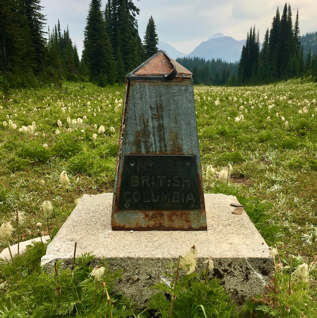
Back on the B.C./Alberta border again at Palliser Pass.
I awoke early to heavy winds above the mountain tops, but no clouds were in sight from the small basin I called home for the night. I hurriedly got on trail, just in case some weather was coming in, because I knew it’s never a good idea to be on a pass with a storm overhead. The light dew on the grass along the trail dampens my shoes and gaiters as I hike the short 100m climb to the pass proper. I spend a few moments looking over the first lake, which is the headwaters of the Palliser River. I always enjoy being at the very source of a river or creek and feel a true sense of wild and awe in these places. They are literally the arteries and veins of our lands, by transporting the next most important thing to life on this planet, besides oxygen – water. It only takes thirty minutes and I’m over the pass. The pass itself being a fifty meter wide stretch of mostly flat grass and green plants, with rugged peaks on either side creating the height of land. Right in the middle of this field of vegetation lay a sheet metal marker on a concrete pad, to signify the border of Alberta on one side and British Columbia on the other. From this height of land two important tributary rivers flow, one from each side. Flowing to the South West, the Palliser River in British Columbia. This is a tributary of the Kootenay river, which in turn is a tributary of the Columbia river, terminating in the Pacific Ocean at Astoria, Washington, USA. The water flowing to the North East from this pass is known as the Spray River, which is a tributary of the Bow river in Alberta, and in turn the South Saskatchewan River, and after mixing with other rivers and large lakes, eventually makes it to the Atlantic Ocean.
Below the headwaters of the Spray River, Alberta.
Once over the pass I walk by the two more headwater lakes of the spray river. It is amazingly beautiful country. Lush and green near the waters edge, with thick patches of forest growing on the higher ground away from the braided creeks moving through the gently sloping land. This was true wilderness and also the type of terrain I expect to see either a moose or a grizzly bear. I would end up walked through this similar looking terrain through the whole of this day and half of the next. Not long after this moment the growing cumulous clouds began to group up tightly, grow taller and darker and the rain soon begins to fall. I was prepared for wet weather with a set of new gortex, breathable rain pants to pair along with my old, but trusty rain jacket. By lunch the weather had not let off and since I decided to leave my small lightweight tarp at home, I was having trouble finding a dry spot to sit. Many of the trees being spruce and the bows to close to the ground to shelter under, save for the odd family of grouse. I decide to push past my planned lunch spot at Lemon Lake, while stopping to look down the wet side trail heading West. “There will be no swimming for me today”, I said aloud to myself and pushed on to camp the remaining 4kms, while cramming a few energy and protein bars into my mouth.
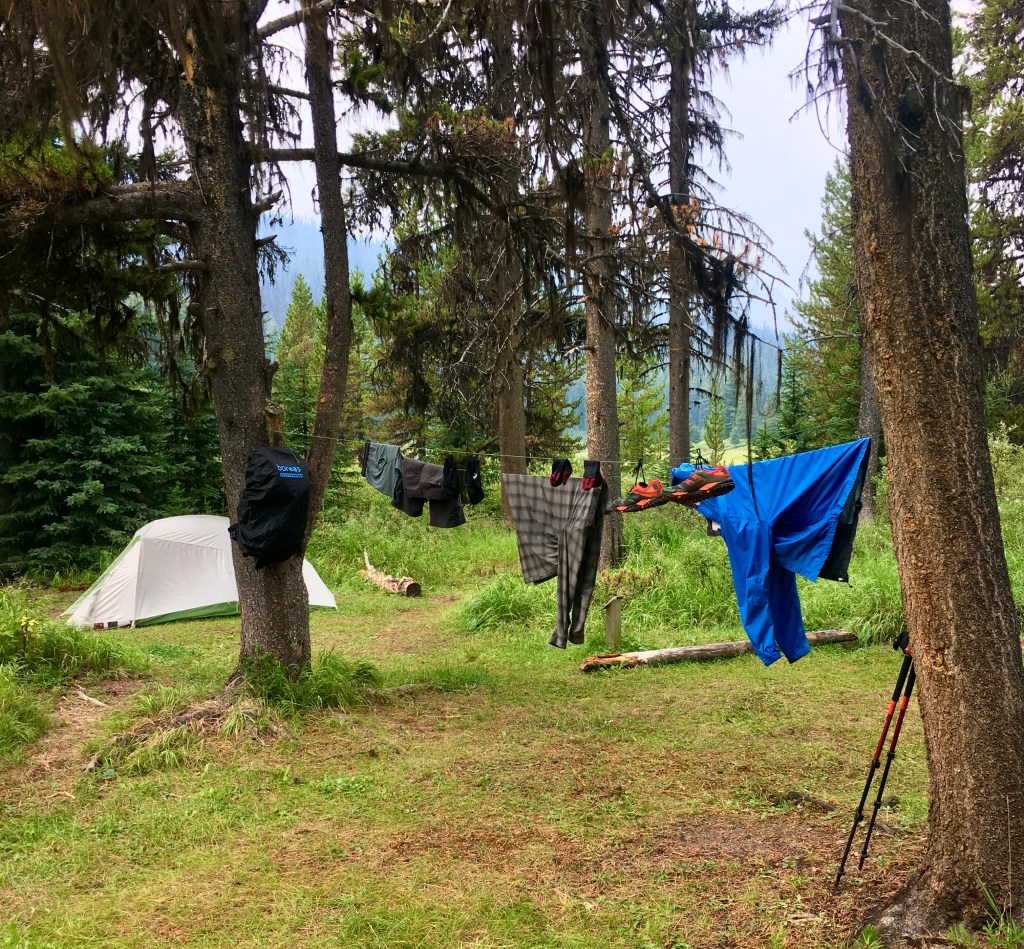
By 3pm I had made it to my permitted camp for the day – Birdwood Camp. This camp is overgrown with tall grass and has trails running through it like animal runs, to each and every tent site and finally to the cooking area, which was tucked into a thick grove of old spruce trees far back away from the creek, which you couldn’t access from camp. The outhouse leaning over, due to rot, had a pile of human feces laying outside of the door. It was obvious there hadn’t been much energy put into this area in some time. I walk back down the trail about 700 meters to a bridge I had crossed before camp to get some needed cooking and drinking water. The water now back at camp, filtered and in my small pot, began to boil over my canister stove. I decided to try and warm up my core with an early dinner and a cup of tea, followed by a packet of hot chocolate. Luckily the rain completely let up and I was able to setup my tent and dry out my gear that evening……… most of it anyway.
Day 4:
Birdwood (Mt.) Camp to Big Springs Camp - 12km, 100m Gain and 250m Loss.
Birdwood Camp, Upper Spray River Valley, Alberta.
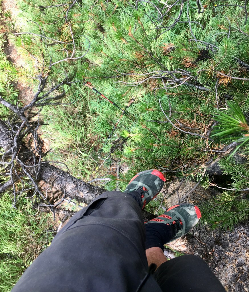
My eyes open in the morning to complete silence. I can’t figure out why there are no birds chirping, or singing. There isn’t a squirrel causing me to rise early and it seems quite odd. I open one of the tent doors to find the skies incredibly clear, now that the storm has let up, but a thick frost on the ground not often seen in August. A cold front came in behind the rain last night and my shoes, which were still wet and hanging in the tree are now frozen solid. It is quite chilly and I decide to take a bit more time and let the sun warm everything up, before I get out of my tent. By the time I am satisfied that my shoes were pliable enough to put on, camp packed up and my belly full, it is almost 12pm. “Wow!”, I thought. “Where did the time go today?”. Now feeling quite behind, I am moving quickly down the flat trail, which veers away from the open terrain around the river and moves through the forest for a short time. Once back along side the familiar feel of the Upper Spray River Valley, I stop to take a picture of the area. I put my phone back in my pocket and just begin to start walking, when I catch something dark out of the corner of my left eye. “Holy shit!” I said aloud to myself. “It’s a Grizzly Bear!”

Captured just before seeing the Grizzly Bear.
Since this is not my first bear encounter, I know exactly what to do – or so I thought. The bear, who is almost paralleling my route less than 100m away, is gradually getting closer and doesn’t seem to notice me. I hollered out in its direction, “Hi Bear!”, but it doesn’t pay any bother to me or it doesn’t hear me? I decide I don’t want to meet up with it in the thick woods ahead and try again. “Hey Bear!!!”, this time I yelled out, trying to make myself heard above the braided water courses and slight breeze in the tight valley. The silver haired bruin finally heard me and with a quick glance of its piercing black eyes, I was surprised to see it charging directly at me. Dumbfounded, I spend important seconds staring at the beast running at me, now splashing through one of the river braids on its way toward me. Next my mind springs into action and I instinctively pull out my bear spray and hold it up. With my wits mostly about me, I know not to run, yet I feel rather silly standing here on the trail waiting for the upset animal to run me over. I look around and notice an abnormally large and twisted pine tree, which is forked some 6 feet up off of the ground. The gnarly old tree had a bunch of large four inch or larger in diameter branches, starting about 10 feet up the tree. This looked like a good defensive position to me, where I could spray the bear if it decided to get close enough, but be semi protected. I covered the 10 foot distance to the tree and had unknowingly sprang almost all the way up to the lower branches. I quickly got a few of the hefty branches below me as I climbed a bit further up. I’m now standing in the tree with my bear spray pointed in the direction of the approaching bear, but I can’t see it, due to a clump of trees now between us.
My trekking poles laying on the forest floor. Ditched, while hastily climbing the tree.
The bear never materializes from the clump of trees and I wonder where it has went. I continue to call for the bear trying to see if I can entice movement and find an indication of its location. I hear nothing. After a few moments, I pull out my inReach messaging device and send a message to a close friend – Justin. He is my emergency contact for this trip and I want to make sure that he has my location, just incase something goes wrong. I spend a very long 40 minutes in total up the old cone bearing tree. Eventually, I am satisfied the grizzly has left the area and I decide to get down. The only problem is, I had literally climbed up the tree like a ninja warrior, in my haste to find security. I find that my only way down is to hang, with my heavy bag still on my back and fall from the lowest of the branches. With a hard crash, I am on the ground with a thud. I spring to my feet with my poles back in one hand and bear spray in the other. With a new view and perspective, being back on the ground, I quickly look around to see if the bear is anywhere near. To my delight I see nothing, but forest and the now empty river valley. Knowing the bear may not be too far off, I move along the trail keeping an eye out over my shoulder.
Near junction of Palliser River Trail and Bryant Creek Trail, Alberta.
On route to Assiniboine Provincial Park, British Columbia.
After joining, the now 3 foot wide Bryant Creek Trail meant for horses and people alike, I see the first humans I have seen in two and a half days. I throw them a quick wave, but decide to move on without talking to them, the morning’s events too fresh on my mind. Turning away from the wild and scenic Upper Spray River Valley, just before it transforms into the Spray River Reservoir, I head west moving through the widening valley. The last four kilometres to camp goes by quickly on the relatively flat trail, as I wind through the Pine and Fir tree forest. I setup my tent in camp, not far from a tributary of Bryant Creek and then head down to the cook area. The topic of conversation over dinner mostly consisted of my hair raising experience that day, while talking with a family of hikers in the camp cook area. It helped me to talk about the events with them, but it seemed to put them on edge, realizing they were in fact now in the wilderness and not in the city anymore. Big Springs camp has as a relatively relaxing feel, even though the tent pads are quite near the main trail in a busy section of Banff National Park. With the sound of the creek quietly rushing by, I drift off to sleep without the thought of bears on my mind.
Day 5:
Big Springs Camp to Magog Lake Camp - 18km, 650m Gain and 100m Loss.
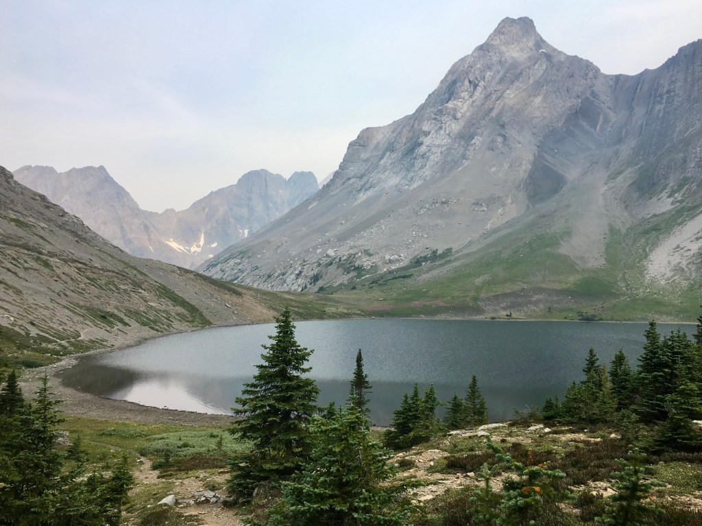
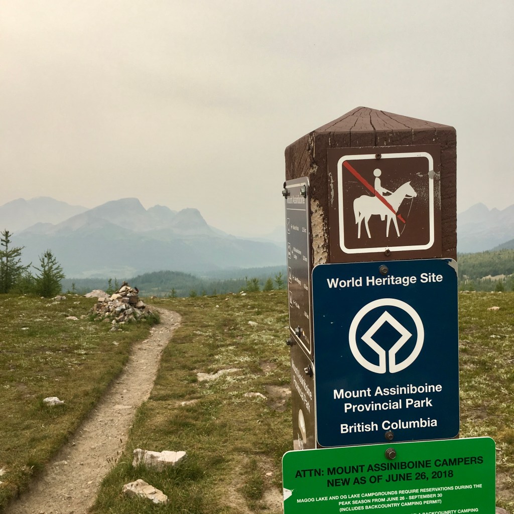
With the majestic looking Marvel Lake only 5km away and the skies still clear of forest fire smoke, I decide to skip my normal breakfast, crush a couple of energy bars and hit the trail. The wide trail, still twisting and turning through the forest, changes to a single track at a junction I arrive at. The wide horse trail continues into Assiniboine Provincial Park over an easier mountain pass along the divide – Assiniboine Pass, while I take the newer route of the Great Divide Trail over the aptly named Wonder Pass. Breakfast was an hour long affair by the time I took in the views and played professional photographer for the morning, at the end of the lake.
Iconic Marvel Lake, Banff National Park, Alberta and Continental Divide, Canada.
The trail slowly gains elevation as it moves south west along the 5km long lake and up out of the thick forest. This section of trail is drier and more open, as it moves along the side of the mountain. It takes me longer than it should have, due to all of the extra breaks to take in the mind blowing scenery all around me. I pass many hikers on my way up to Wonder Pass, who were all headed out to the Mount Shark access trail, after their exciting trips through Assiniboine Provincial Park. Gaining the last few hundred meters to the pass and into the B.C. was a real treat moving through the rocky, but mostly green alpine basin. Water was flowing near by to the lake below me and towering cliffs on two sides. Just as I near the top I feel a strong wind blow against my back. Along with the gusts of wind came the all too familiar smells of forest fire smoke.
Wonder Pass, on the border of B.C. and Alberta, Great Divide, Canada.
Forest Fire Smoke blows into the large sub-alpine basin of Assiniboine Provincial Park, B.C.
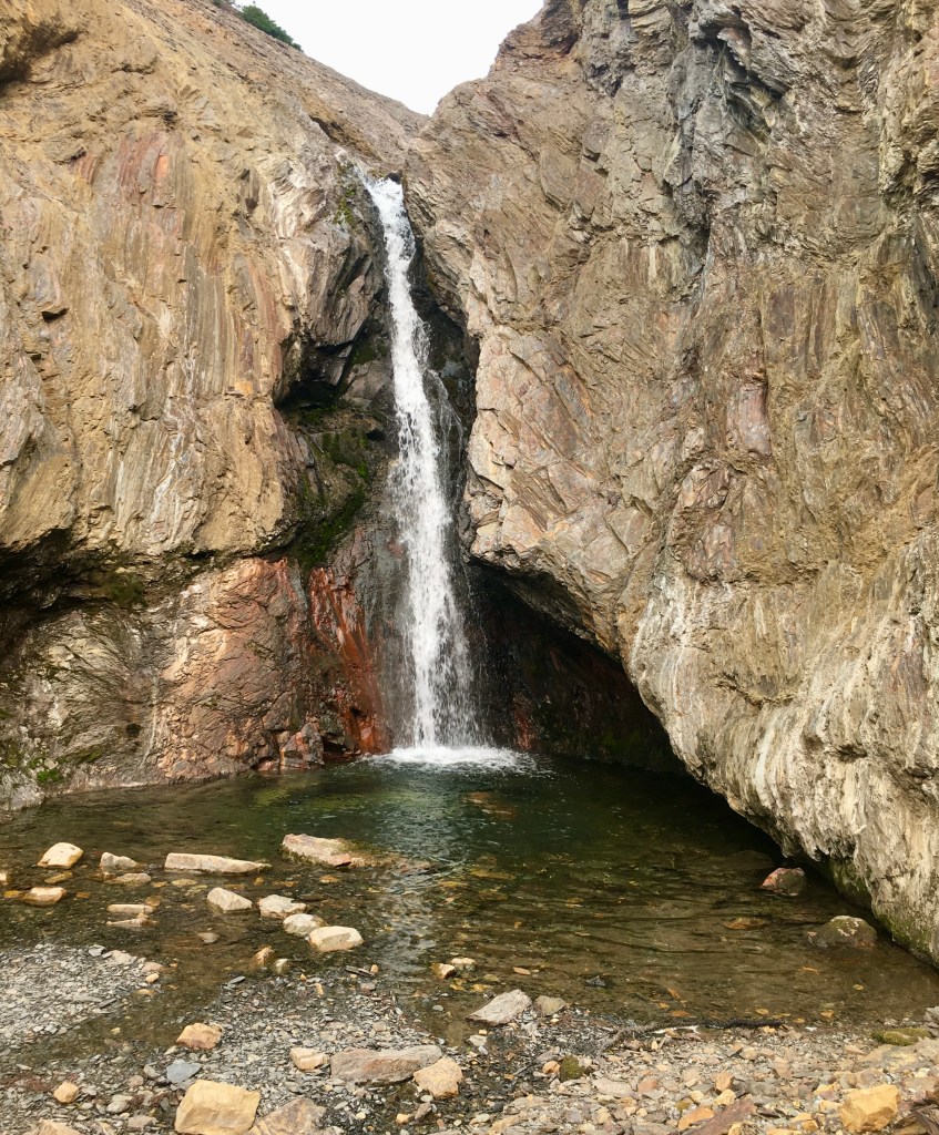
Even with the smoke subtracting from the power of the views, I can feel a strong draw or energy pulling me into the basin. This is a sought after little corner of the planet, which I finally have my opportunity to briefly explore and I am incredibly excited. Not far below the pass I hear the sound of gushing water. To my surprise I come across a beautiful waterfall, with water cascading down between the rocks into a small pool below. I had not fully immersed myself and had a proper clean, since the creek skinny dip at the end of day two. The whole Upper Spray River Valley closed to swimming to prevent the spread of “Whirling Disease”, which is fatal to the trout and char species in the rockies. The day is hot and I am sweaty and dirty. After digging out my light weight pack towel, I carefully climb down to the small pool, take off all of my clothes and jump in with a loud yell. The water is freezing, but its great to clean up and feel refreshed.
Magog Creek.
On Route to its destination at Magog Lake, Assiniboine Provincial Park, B.C.
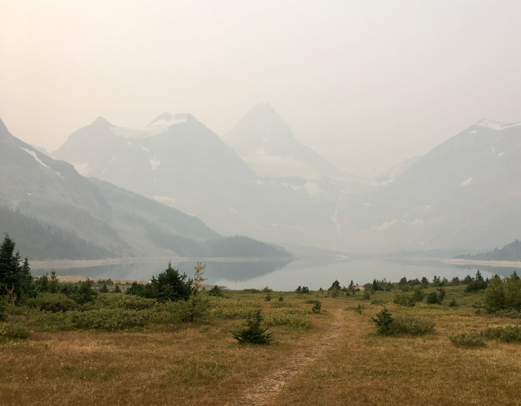
Clean and moving downhill away from the pass, I moved through the basin the easy 4km to camp. As I walked through the lovely meadows and by the creeks, alpine lakes and small tarns that the exist along the trail, I have a sense of heightened energy. The basin was quite alive from the buzz of bees, sounds of birds and whistles of ground squirrels thriving in this high elevation environment. Getting closer to Magog Lake camp I came across many more people, small wood cabins (Naiset Huts), a cook shelter for the cabins and raised wooden walkways to help protect the delicate ground surface in the area. Passing by Magog Lake and the world famous Assiniboine Mountain I am saddened by the fact that I can barely see the shoreline of the lake, let alone any of the mountain. With dry, mostly dead grass around the lake, you could see the affect the dry summer had on the sub-alpine basin. After taking in high tea at the also famous Assiniboine Park Lodge, I continue on to camp in hopes the wind will clear the smoke again and give me an opportunity to see the 3000m tall giant. Magog lake camp, now enlarged for the massive crowds that have grown and grown over the years, is completely full. I spend my evening eating, stretching and trying to keep to myself, despite the many questions about my solo adventure.
Day 6:
Magog Lake Camp to Porcupine Camp - 12km, 75m Gain and 300m Loss.
Breakfast is a feeling of success and defeat this morning, while I sit by the waters edge staring at the outline of the iconic peak – Mount Assiniboine. I have hiked 70km to get to what I consider the highlight of the trip and now it was barely visible through the smoke. This was another one of those learning lessons about wilderness adventures, especially in the unpredictable summers of Canada’s back country. I have had numerous trips foiled due to weather, snow, forest fire closures and even injuries prior to the trip. The most important thing for all of us to remember in times like these is that the mountains will always be there and at least in our lifetimes, so should the lakes, rivers and tributaries.
Assiniboine Mountain and Magog Lake.
Barely visible just after breakfast, the morning of day six.
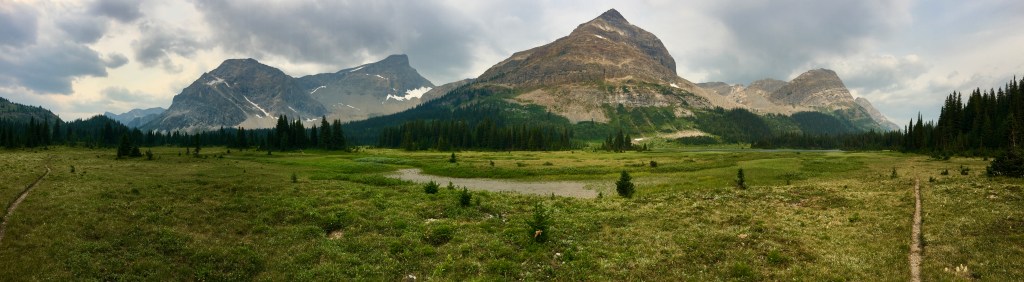
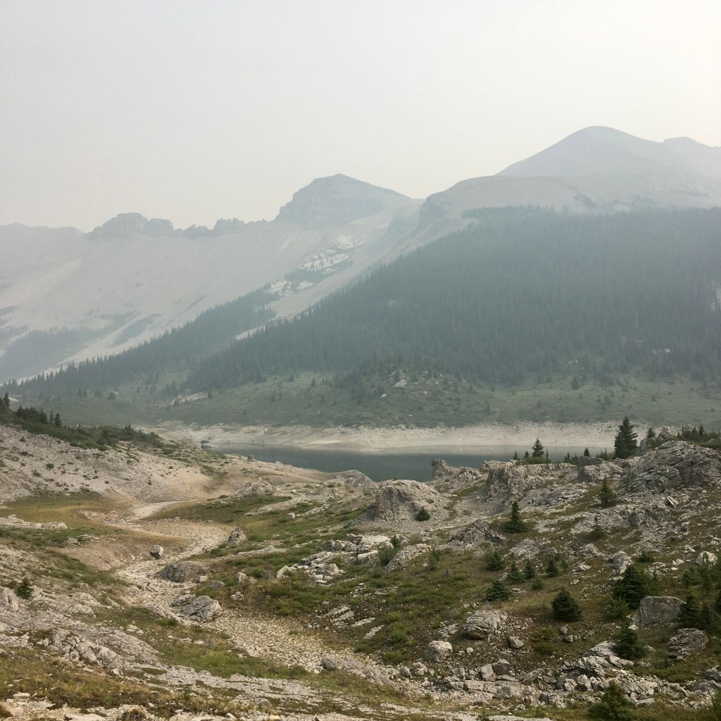
I am on my feet and moving north down the trail before 9am. This is the most populous section of the whole trip, besides the very end. There are people coming and going from all directions, including getting drops by helicopter from Canmore. The lodge is beautiful and if you can afford it and book in advance, it will be a fancy getaway, but doesn’t sit high on the list for a guy like me. The terrain between Assiniboine lodge and Og Lake for the most part consists of a thin strip of forest on each side of the narrow long valley, along the bottoms of the mountains. The rocky mid to top of each is exposed for my viewing. The central portion of the valley is at times sparse forest, long narrow meadows of grass, brush and flowers. All of which have lost their usual green glow from the hot and dry summer. Every now and then a water hole in a depression exists to break things up and Og creek is never too far off of the trail to the east, even if unseen to the eye. Even though the smoke is quite thick again, it still allows the sun to heat up the air and at times can create a humid greenhouse affect and I am feeling that today in the open terrain. The 6kms to Og Lake takes only a few hours of casual hiking through the relatively flat rolling terrain, that was steadily dropping toward a low point at my camp for the day. As I near the lake I notice the area is speckled with unique rock formations and has a sort of ominous feel to it. I have a long lunch just up from the waters edge at the breezy Og Lake campsite. This was one of the many campsites I tried to book, while creating my itinerary for this trip, but was denied due to lack of vacancy. The main theme for the day was passing by many hikers and is definitely a noticeably busier area than anywhere else the past six days.
Unique rock formations near Og Lake, Assiniboine Provincial Park.
Between Og Lake and Citadel Pass there is a deep valley and the permit-less Porcupine Creek Camp is down at the very bottom. For me to access this camp I need to leave the Great divide Trail for 3km and take the Simpson River Trail exit that leads to Kootenay Park, if you continue to the end. Since this is a first come first serve camp, I am happy to be rolling into camp just before 3pm after a rather easy day on trail. The last six days have made me stronger in body and mind. Having a back pack that gets lighter each day as I eat my food doesn’t hurt either. I picked the my usual tent site – the furthest back from the cook area. I thought nice and private and settled in for a nap. Porcupine Creek Camp being about 12km from Sunshine Ski Resort Gondola, a permit less camp, along with Og Lake being often booked up, has created this kind off lawless atmosphere at this camp at times and I didn’t really enjoy it. People just kept coming and before long tents were crammed in the small forest camp and my peaceful back corner filled up quickly. The dinner atmosphere is great with a lot of stories being thrown around and questions asked. Everyone was in a really good mood, most of them on their first night of four or five day trips. The air was quite a bit warmer down in the lower elevation creek bed and the air hung thick. I was close to nodding off as I heard a person in the tent near me begin to snore. I felt around searching for the tent pockets and am relieved to feel the bulge of disposable ear plugs. Before long I forget about the sleep depriving sound and drift off to sleep for the last time on this trip.
Day 7:
Porcupine Camp to Sunshine Ski Resort - 12km, 800m Gain and 500m Loss.
My Introverted mindset is getting a bit over stimulated with all of the people in this small camp. I am up early and mostly packed before I stake a claim on one of the benches in the eating area. There are only a few others up and we keep the talking to a minimum as many are heavily focused on getting that first cup of coffee under their noses and past their impatient lips. The climbing starts right at the edge of camp. First there is a really steep pitch heading north out of camp to connect back with the Great Divide Trail. This gets me back to the trail faster, but is much steeper than the trail I came in on yesterday. After gaining the extra 100m from camp back to the trail, my next challenge is to top out on Citadel Pass. The damp morning switchbacking up through the forest below the pass is refreshing and even though the 700m plus climb is steep it didn’t take me more than a few hours to get to the top. Being outside in the morning is a pleasure of mine, especially climbing mountain passes, as the sun is coming up. I take a look back out over the drainage I dropped into yesterday and climbed out of this morning and pat myself on the back knowing I have only 100m more to climb on the whole trip.

The Beginning of the popular Sunshine Meadows – Banff National Park, Alberta.
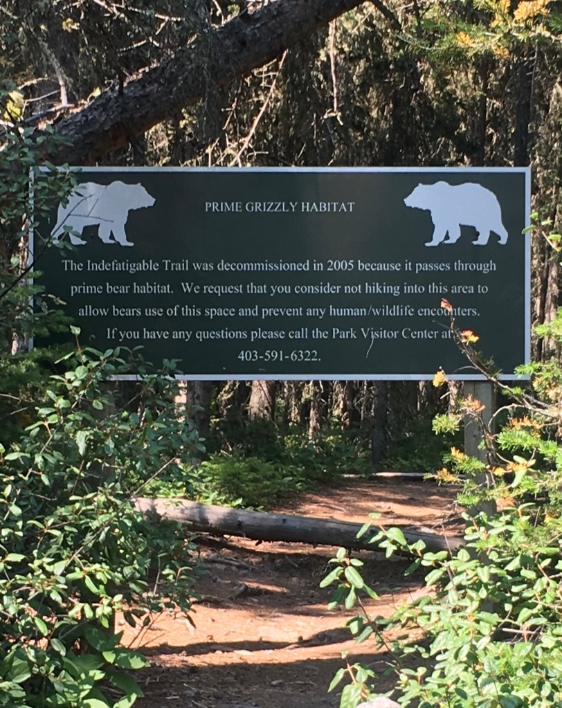
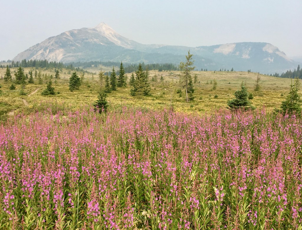
With just 9km to the finish I take my time on this last day. The popular Sunshine Meadows begins not long after the pass heading north. These expansive 2200m high meadows sprawl across the crest of the Great Divide and during the summer are well known for providing one of the finest display of wildflowers in the Canadian Rockies. This is also perfect grizzly bear habitat and I pass numerous bear digs not far from the trail. I came across a giant bed of wild fire weed, known in some parts of the world as willowherb or rosebay. It is a pinkish/purple flower that is known to be one of the first plants to grow after a wildfire. If you can remember back to the beginning of day two, I came across a much larger bed of fireweed at North Kananaskis Pass and it even stretched quite a distance up the avalanche path on the side of the mountain. The most important thing about this bed was the fact that there seemed to be about one thousand honey bees working at full force, trying to get the last of the pollen before the flowers completely dry up for the season. I can hear it long before I see it, my senses seemingly more in tune to my surroundings. This was another one of those times on trail, where I found myself fully present and was almost entranced by the buzz, as I gazed over the flowers, bees and landscape for quite some time.
Large fire weed bed.
Sunshine Meadows, Banff National Park, Alberta.
Howard Douglas Lake appears 500m in the distance, from a small 50m rise I just ascended. Being a bit past noon and getting hungry I decide to stop for one last trail lunch in this lush green basin, which seems less untouched by the scorching sun all summer. One of the few things I had left in my backpack was a ziplock bag containing a full package of Annie’ Macaroni and Cheese – one of my all-time favourites on trail.
Howard Douglas Lake, Banff National Park, Alberta.
With a full belly and a renewed energy I made the final 100m climb of the trip. The last 4km was spread out in front of me and in the distance I could see one of Sunshine Ski Resort’s lifts in far back up alight rise. Between me and than point was a small up and down, and then another large 3km plus meadow of grass and a few remaining flowers. I deiced right there to eat my last energy bar, which happened to be a snickers – saved the best for last! It was a bittersweet walk across that last rolling meadow. I feel sad knowing that the nights sleeping soundly in my tent and the days spent entirely outside are coming to an end. Being away from the distractions of a busy life gave me space to think about what is truly important in my life and where I want to put my energy in the coming years. The past seven days I crossed mountain passes, through numerous different drainages, creeks and forests, as well as criss-crossed over the continental divide 7 different times. I learned the importance of seeing the forest for the trees, the birds and squirrels for their conversation, when there is no-one else around, the bees for the hard work that they do, bears for reminding me to be more humble and water for the life it brings to us, beginning in these magical high places.
2km remain to Sunshine Ski Resort, Alberta.
I reach a high ground where a few trails converge, I pass over the B.C./Alberta border one more time and suddenly there are people everywhere! Many not in hiking boots or trail runners and carrying large back packs. Some were wearing casual clothes and even sandals at times – not all, but some. Thinking I was at the end, I still had another kilometre to go, before I was in the village proper. Luckily for hikers in the area, the Mad Trapper’s pub is open during the summer months. I am in heaven, despite my hike being over I had been thinking about a hamburger and fries for the past few days now. The thought of a warm and greasy burger and crispy fries can’t be beat after many days of eating dehydrated meals and energy bars. Now that I downed the refreshing cold beer, and devoured the greasy pub meal I am in need of a serious nap. I decide to cheat and take the bus down to the lower parking lot, so while I await the arrival I take the opportunity to have a short nap under the shade of the lodge roof edge, on the cool grass. I am so full I almost fall asleep on the 5km bus ride down to my waiting pick up truck. I have hiked over 110km in the last seven days and I am truly proud of my accomplishment.
Getting Home:
This trip was relatively simple and that’s how I planned it out to be. I had left my truck in the Sunshine Ski Resort parking lot seven days prior, on my way to the start of the hike. For me it was nothing more than a simple, but always enchanting drive back through a portion of Banff National Park and through all of Kootenay National Park, back to my relatively quite home town, near the headwaters of the mighty Columbia River.
Conclusion:
I had originally wanted to do longer days on trail, but in the end this was a good pace for my first solo adventure and a good overall length. It was nice to slowly build up my experience over the years and this was another good step in the direction I am heading. With a busy permitting system, and many camp areas requiring use of existing camps, due to being in National or Provincial Parks, Section C either requires a few really long days or lots of short ones – pick your poison wisely.
With the Egypt lake and Rockwall Trail portions of the Great Divide Trail still closed, due to forest fires I head home, unpack and cleanup myself and my gear. Two days later half of the Rock Wall Trail opens up and I get a call from my friend Justin wanting to join me for the three day trip. We decide to hike a 44km loop, starting at Paint Pots Trail head in Kootenay National Park, B.C., which reaches the Great Divide Trail, at Tumbling Creek Camp – the rough mid point of the Rock Wall Trail. Tumbling creek camp being my favourite of that trail and it didn’t disappoint. While playing a game of chess on one of our cell phones, we had a young 3 or so year old grizzly visit the camp that night. With a quick sniff of Justin’s tent, to make sure there was no food in there, it was off and gone as fast as it came. The next day we ascend Rockwall Pass, a high meadow pass, similar to Sunshine Meadows, but much smaller and then descend to the often damp Helmet Falls Camp. Helmet Falls being the 11th tallest waterfall in Canada at 352m is always a site to see. Luckily the cooking area for this camp has a perfect view of the falls and surrounding “rock wall” and is absolutely gorgeous. With an easy 15km out the last day it was time to head home for a good rest. In the end I only managed to miss out on about 50km of the trail, after taking two days off, before heading back out.
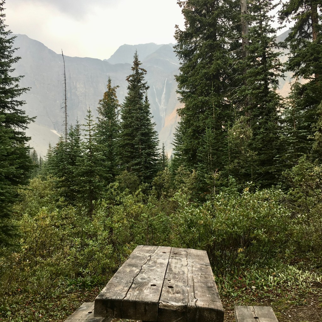
Helmet falls, Kootenay National Park, B.C.
I would later find out, after speaking with a warden about the bear incident in the upper spray river valley, that I most likely scared the bear and it bluff charged me, to try and scare me off. This is a normal use of aggression by Grizzly Bears to entice a run, but if you run you are in fact prey. Against popular belief bears are not always out to kill us and often just want to be left alone. The warden had warned me that they recommend we leave bears be as much as possible or move off the trail to let them pass, especially with an element of water/noise involved. It would have been best to wait it out rather than acting like a privileged human and think I can scare it off with my voice, all by myself. I had realized later that I was not making enough noise that morning, which is often enough to keep most predators at bay. During past bear encounters, when I have been in groups of 2-5 people, I have never had a bluff charge and found they often run away as soon as they saw or heard us. Don’t let this story scare you off. I recommend spending some time to get bear aware, learn how to properly use your bear spray and make lots of noise. I also recommend learning how to defend against a mountain lion attack, if travelling alone in the Pacific North West back country, which can be a bit of a different experience than dealing with a grizzly bear. Knowledge is power!
I am slowly learning it, but it seems to me that true happiness in life can only come from being present in each moment. With the distractions of a modern and busy world it can be difficult for some of us to find these moments in our everyday lives. Something I began to learn on this trip, without quite knowing it for a few more years to come, was that I had begun to slow down and observe my surroundings better. Observing with your senses, especially with your smell, hearing and touch seems to help create a true connection to the moment and when I am in the wilderness I find it much more easy to practice this. I really enjoy my trips away, because I always come back changed in some way, shape or form – often stronger or more capable. This is just the beginning of this long distance adventure thing for me.
What does being present in nature do for you? How does it make you feel? What sort of feelings do you get after spending a day, week or longer in the back country. Let me know in the comment section.
Keep following along for more human powered adventures, blogs and tips. Make sure to get out of your comfort zone.
Happy adventuring!
Tyerel Raven

Leave a comment