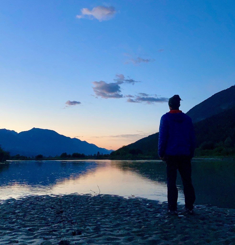
"I think most people who have lived out of a tent for more than a weeks time, being in the fresh air, going to bed and getting up with the sun, the feeling of freedom and having everything you need to survive in such a small space knows it can become addicting - it can become home."
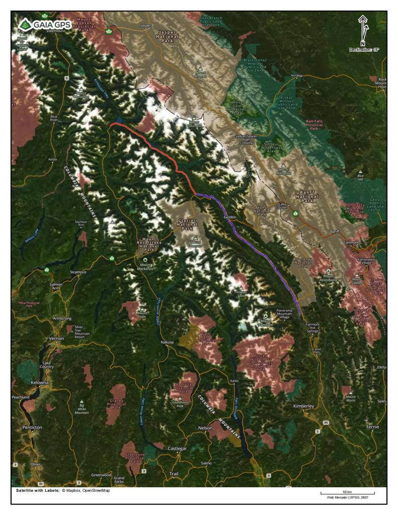
Route: Invermere, British Columbia to Micha Dam, British Columbia (Kinbasket Lake – Reservoir).
Trip Length: 300km – 170km on the river, 10km by cart portage and 120km on the reservoir.
Trip Dates: September 4th, 2021 to September 15th, 2021 – 12 days travelling by canoe and by foot.
Special Notes: Although it’s never too far from highway 95, the upper reaches of the Columbia River can have a relaxed wilderness feel, between the town of Invermere and city of Golden. Even with mostly slow moving water, there are places where you can get yourself into trouble. Beyond Golden the river speed picks up slightly and turns into swift water, but no actual rapids are present, until just before and in the Donald Canyon. Kinbasket Lake can be a dangerous place if you are not experienced with water and wilderness travel – this can be due to severe weather, fluctuating water levels, lack of camping locations and the ruggedness and remoteness of much of the shoreline.
The River:
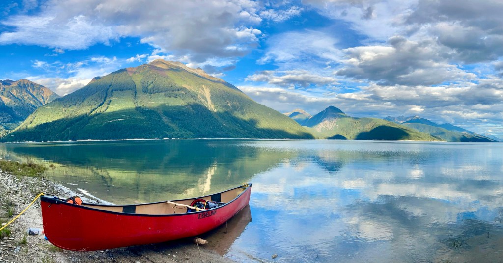
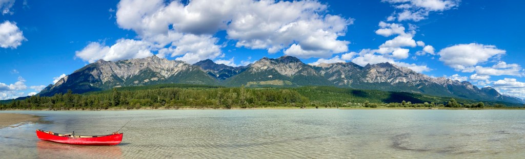
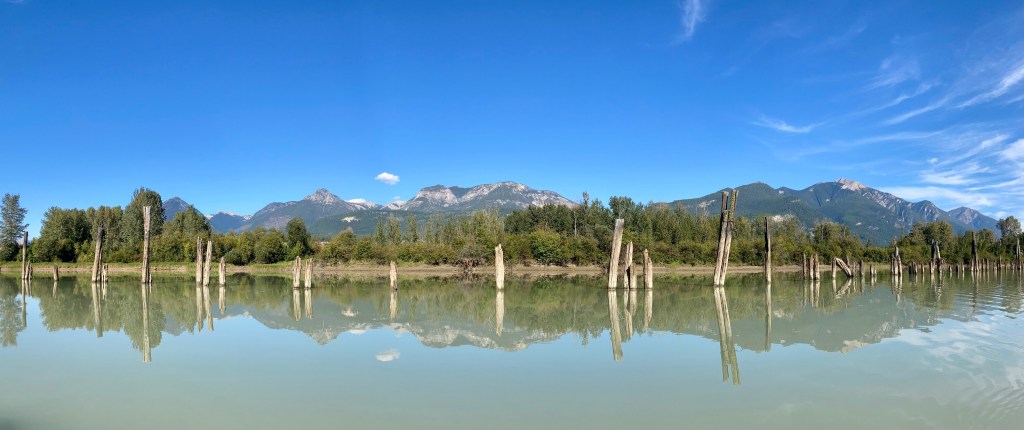
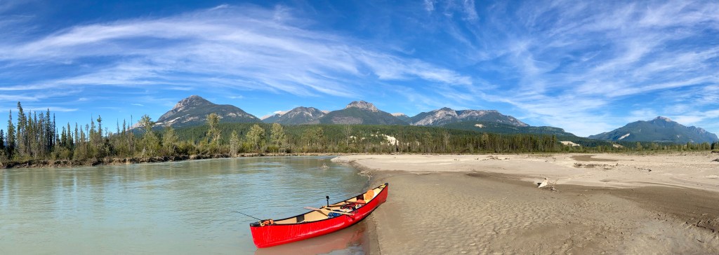
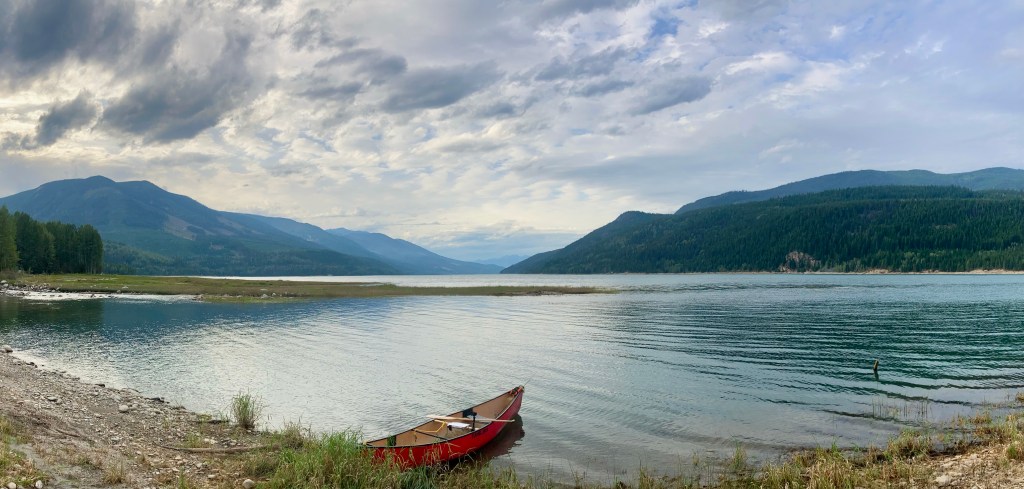
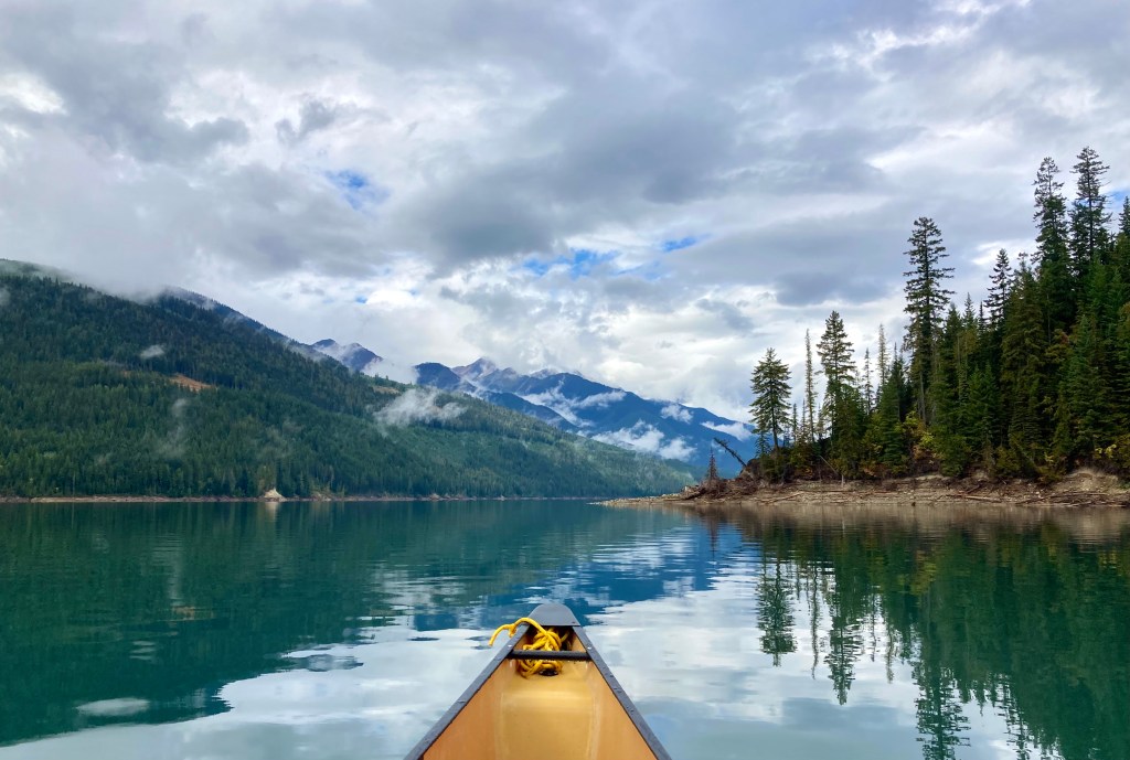
The “Mighty” Columbia River, as it is most famously known, begins its 2000km (1200miles) long journey to the Pacific Ocean near a unique mountain town – Canal Flats, British Columbia. The river travels north for 320km (200miles), before turning south in “Big Bend Country”, near the present day Mica Dam. The headwater lake aptly known as Columbia Lake sits at an elevation of 800 meters (2600 feet) above sea level, in the middle of a long glacial carved valley known as the Rocky Mountain Trench. The area is a hotspot for tourism containing knockout views of the Purcell Mountain Range to the west, the world famous Canadian Rockies to the east, and many lakes, rivers and trails to explore. The Columbia River drains 670,807 square kilometres (259,000 square miles) of land, from ten principal tributaries, which are mostly fed, if not themselves, from high mountain or glacial drainages. These seasonal waterways swell in the spring, when temperatures climb high enough to melt last winters snow on the mountain slopes and from heavy spring rain falls. For a few months time the streams, creeks and rivers flow at a significantly higher volume, than the shoulder seasons, winter of course being the lowest of water levels. Due to this dangerously high volume of water in the spring, almost all of the ledges and water falls on the Columbia River have been transformed into dams for flood control downstream – many of which create hydro electric power as well. Mica Dam, completed in 1973, by way of the Columbia River Treaty of 1961, made it possible to create the Kinbasket Lake as we know it today. The modern lake was originally named McNaughton Lake, until the name was changed back to the name of the original much smaller lake that existed in the area – Kinbasket Lake, which was named after a Chief of the Shuswap First Nation – Secwépemc. This massive reservoir is 260km long and is made up of two main river reaches. On the south end the Columbia River feeds the reservoir north of Golden B.C. , while the Canoe River, a tributary of the Columbia, feeds the northern end, near Valemount, B.C. . Some of the towns that are now submerged after the flooding of the reservoir include, but are not limited to Downie, La Porte, Big Bend, Mica and Boat Encampment (an original David Thompson camp, later turned Hudson’s Bay Trading Post).
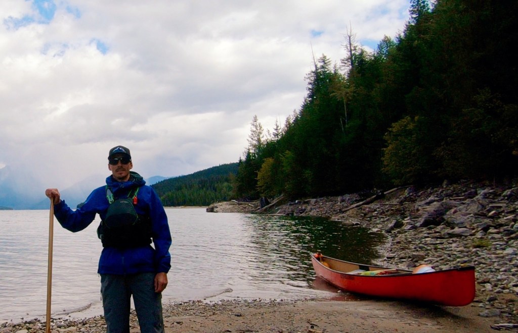
My Adventure:
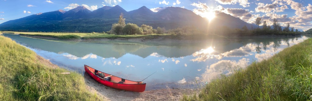
This trip all started, because I had just purchased a canoe and I wanted to get out on my first long trip. As with all of my longer, previous trips, I couldn’t find anyone that wanted or could join me – so I decided I would once again go alone. Since this was my first long and solo canoe trip I decided to take my regular approach and create some limitations for myself. Firstly, I didn’t want to travel too far from home, so pick up at the end is easier. Second, I wanted to have a wild wilderness experience, but I didn’t want to be completely in the middle of nowhere, in case something happened by making a silly “first timer” mistake. I wanted something “long”, but not “too long”, as well as not too difficult. After looking at maps of the area I had decided that the local reaches of the Kootenay River, were a bit too much for me at the time, without proper whitewater training.
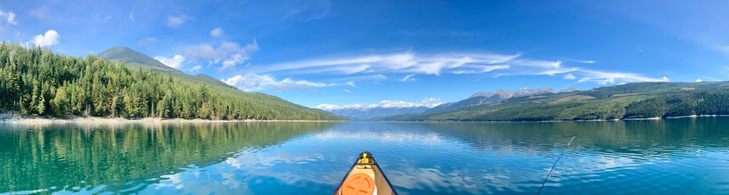
I had heard wild stories of intense storms, big waves, as well as beautiful scenery wild forests and gigantic fish from local fisherman, who had travelled to the lake for summer recreation. Many of these stories were based around locations nearer to the access roads and I was much more interested in the wilder parts of the lake. For many years I had wondered what it actually looked like and became extremely excited with the thought of camping along its shores and exploring this vast waterway, which was never as big in my mind as it is in its physical form.
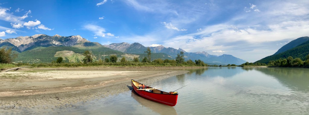
As far as the upper reaches of the Columbia river, I had only really explored and floated the short fairmont stretch and the Invermere to Radium section, as simple mid-summer floats to cool of and enjoy the sun with friends. The thought of paddling from Invermere and beyond Golden to Donald had also peaked my interest, as this is an extremely long section of continuous wetlands containing numerous birds, waterfowl and animals from big to small. It’s twisting and winding channels, containing hidden gems, a selection of routes in areas, as well as absolutely gorgeous mountain views along its entire length. I just had one little problem and that was a narrowing of the Columbia river before the lake. As the river flows south toward the city of Golden, numerous tributaries flow into it adding to the volume of water, which in turn creates a widening of the river through the flatter terrain. Past Golden, the river slowly narrows, as the valley itself does too, until finally just past the small town of Donald, B.C., the river is funnelled into a narrow canyon. Seeing this geological feature on a map you would assume that the river would become very turbulent and un-runnable, at least for someone with my experience level in moving water at the time. All of the online information I could find wrote about large waves and whirlpools in the canyon, which didn’t seem safe to me for my ability.
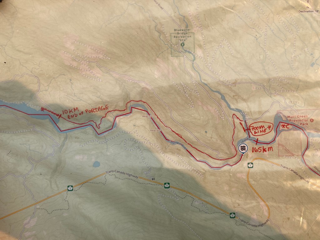
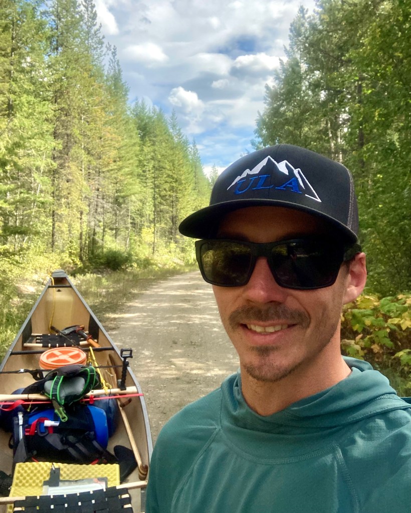
So, for a few weeks I had actually gave up on the trip and thought of maybe just doing the river section alone. Then one day I thought, Im not just some lazy guy who doesn’t know how to walk. I had tackled long hiking trips through the mountains solo and I wasn’t going to let a canyon stop me and my plans. I went back to the map and found a forest service road, that could take me from the river to the lake and skip over the 5km long canyon. It just required a short 800m track up a tributary creek to access the old road. The portage was estimated at 10km, which is too long to do in multiple trips by myself. I knew from experience I could walk with a backpack approximately 5-6km per hour by road and guessed it would only take me a few hours by foot. After a bit more pondering and online research I came across a canoe cart and knew right away I was back on track.
Finally I had my adventure plan. If all things go right I would begin at my hometown of Invermere, B.C., travel down the Columbia River for 165km and then portage my canoe by cart 10km along an old Forest Service Road, mostly paralleling the river below. Once I reach the massive lake there would still be over 130km of travel by canoe along its western shores. This trip would total over 300km. I guessed my daily river travel to be 30km and my daily lake travel to total 20km. Using these numbers I decided that the trip would take me 12 days. Just in case I was held down by high winds on shore and unable to paddle for any amount of time, I decided that I would bring an extra 3 days of food, totalling 15 days worth of rations.
Planning Considerations:
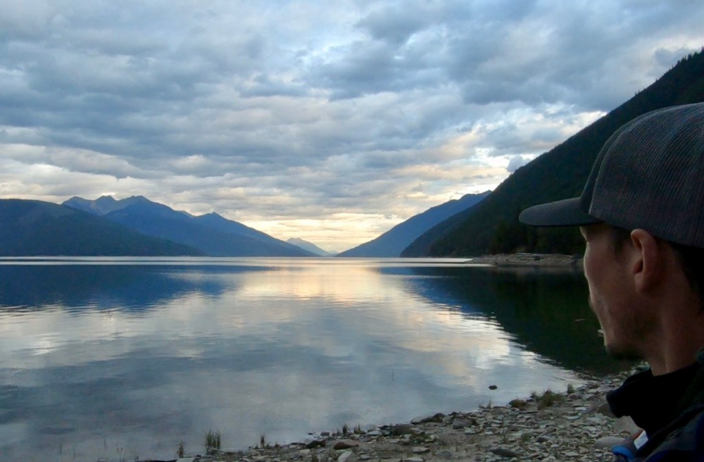
There are areas, where the river widens and winds can slow or prohibit travel, the closer you get to Golden, B.C. . In the early summer months high water levels can greatly reduce dry camping locations throughout the river portion. Other than Columbia lake to Fairmont, Invermere to Radium and Golden to Donald, much of the upper reaches of the Columbia River are a slow moving, almost stagnant waterway, other than during the spring flood. During the fall, when I attempted the trip, more than half of the river portion felt like one long, twisting and winding lake paddle, rather than a laid back float trip. Kinbasket Reservoir is low in the spring and early summer consisting mostly of a narrow river channel(s), especially on the south end and not much water activity can take place. From mid summer on the reservoir should rise to be near or at full brim, until autumn, when waters slowly decrease as run-off from tributaries slows. These are all points to keep in mind if wanting to tackle this route, among others.
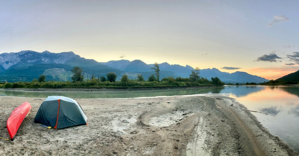
I already had a lot of the much needed wilderness camping and travelling experience, so I really just needed to focus on learning how to properly travel by canoe. Anyone who knows me well, knows that I go “deep down the rabbit hole”, whenever I am interested or passionate about a topic or activity and my perfectionist mindset will not allow me to be merely mediocre in my preparation or pursuit of my passions. I spent a lot of time that summer learning how to maneuver and paddle my canoe, solo canoe re-entry as well as learning canoe theory, such as solo paddling techniques on moving and flat water, canoe safety, whitewater rescue, solo paddling in wind, paddling large flat water, portaging, managing on or offshore winds in a canoe, further weather research,….. and the list goes on.
As with all of my previous trips I used a combination of Gaia and Google Earth online maps to figure out my route, route length, creek locations along the trip, where I could get fresh water to filter, as well as searching for large beaches and points that could make potential camping locations. I created waypoints for all of these important locations on my Gaia account online. The software then allows me to create a set of PDF maps on the Gaia website, that I can send to a local printing shop or print myself. The printed maps are usable as a navigation tool, in conjunction with a compass, as they have both a scale and the degree of declination between magnetic and true north. Along with the paper maps I made sure to download the whole route onto my Gaia account on my phone, which then allows me to use my phone as a GPS device. I keep a waterproof case around my phone and it never leaves the inside pocket of my PFD, right beside my inReach Communication device, while on the water.
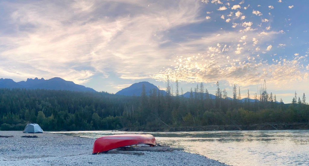
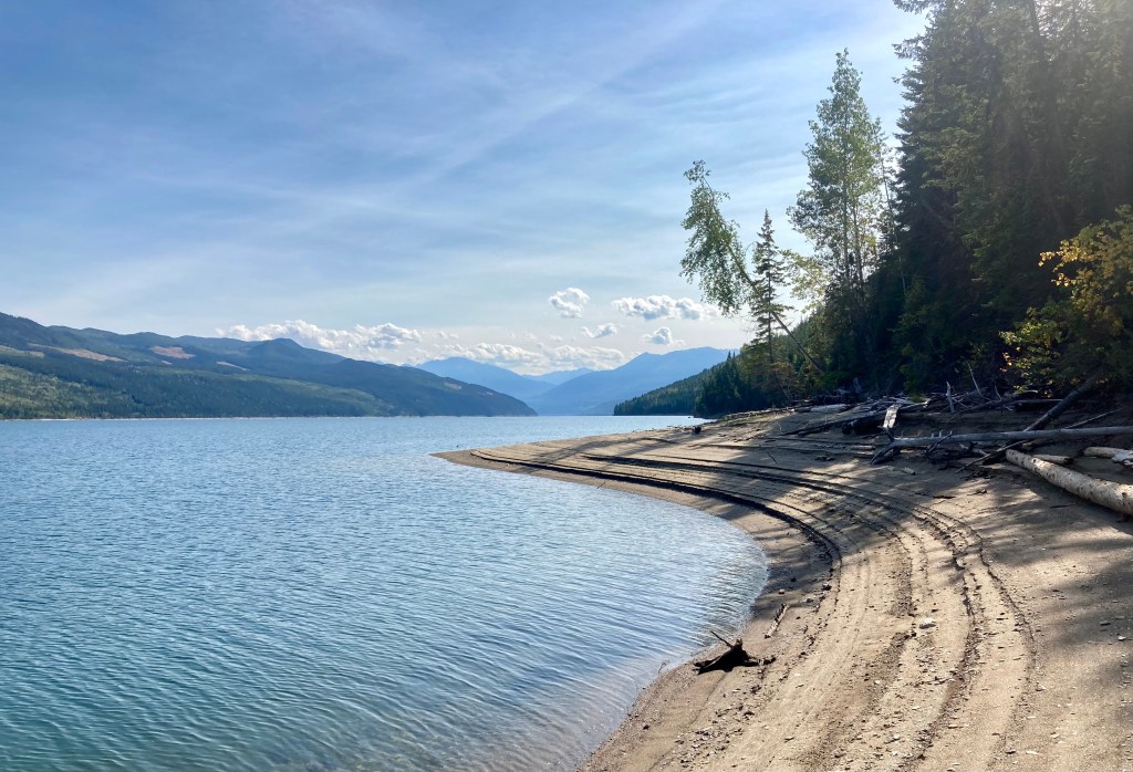
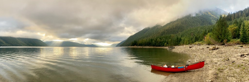
If you plan on tackling this route keep in mind that many days on the lake require a travel of long distances to find a campsite and sometimes it can be tough to even find a place to pull over for a break. Look for bays and coves to take breaks from the wind. If you are able, park your canoe or boat up against floating driftwood logs near the edge of the water to stay clear of the rugged and rocky shoreline. Keep an eye on the topographic lines on your maps to decide on which side of the lake to travel. There are not many camps located along steep shoreline sections of the lake. Often creek and river mouths offer camping options as well as large open beaches noted on satellite map imagery, but not always.
From start to finish the whole route contains bears (both black and grizzly), wolves, moose, and wild cats like the Mountain lion, which can all be very dangerous in a bad interaction. Make sure to carry bear spray, and/or bear bangers along with as much predator behaviour knowledge you can learn. This is a wild environment, please take the time to practice “Leave No Trace” principals and leave your campsites how you found them for the next group or solo travellers.
Getting To The Start:
This is was the easiest adventure start to date, being that I live and work in Invermere. I had a short 2km drive from where I live, down to a small river/lake put-in, right at the mouth of the Columbia river.
Full trip write up coming soon. For now enjoy my video series on YouTube.
Getting Home:
Once again, my parents were a huge help and offered to pick me up at Mica Dam, as with previous trips in the past. I messaged them a day before to let them know I would be at the decided take-out by around 1pm the following day. With a short 15km left to paddle my last day, I didn’t even need to get up early. When I rounded the last point I could see my pick up truck and my parents standing near. Apparently they had only waited about 15 minutes, before they could see me coming in the distance. Once again I had timed things out nicely for my pickup day. This was my first time driving the 135km road between Revelstoke, B.C. and Mica Dam and it was absolutely gorgeous. The road snaked south along forested mountainsides, allowing us views of Revelstoke Lake, another dam created reservoir of the Columbia River, which also lies north of the town of Revelstoke. After 12 days on the water I was craving a greasy burger and fries, so we made a stop in Revelstoke at one of their small burger joints. After a satisfying dinner, we continued on our relaxed 420km drive and were home in just under 5 hours total of driving.
Conclusion:
I think most people who have lived out of a tent for more than a weeks time, being in the fresh air, going to bed and getting up with the sun, the feeling of freedom and having everything you need to survive in such a small space knows it can become addicting – it can become home. Getting to live and travel by way of canoe and by foot for twelve days has pushed my boundaries and the limits that I have placed on myself previously. I feel much stronger now in mind and in body than anytime in my life, now at 38 years of age. Moving each day camp to camp, by an ancient, graceful, slow, simple means and yet such an extremely effective way of transporting goods and people, is a highly rewarding way to travel and see the wilderness. It can be however, a tough and tiresome way to travel, but for me not in a “I don’t want to do this ever again”, kind of tough. Challenge and struggle can create resilient people. Doing trips like this is my way of attempting to make the rest of my day to day life feel a little easier, because let’s be honest, life isn’t easy and its not supposed to be. If I don’t challenge myself enough both mentally and physically throughout the year, I find the modern, very comfortable, privileged human starts to show its ugly head in myself and I don’t like that person. Im not talking about work life, or financial struggle either. Much of that is created by the modern way of living, pushing many to think that they need to live and work beyond their means, as well as higher cost of goods and services globally, most often created by greed. Im talking about struggle with something you are passionate about, something you can be creative with or an activity or hobby that can create an excitement to learn something new, as well as grow you mentally and physically stronger. Some people tackle long trail runs, others spend time at the gym, some climb the highest mountains and others prefer long drawn out “Journeys of Discovery” (David Thompson). We all need to achieve goals and overcome struggles too create character and make us feel fulfilled in life and this is my way of doing it.
Keep Following along for more human powered adventures, blogs and tips. Make sure to get out of your comfort zone.
Happy adventuring!
Tyerel Raven

Leave a comment